
Te Pane-o-Mataaho / Māngere Mountain
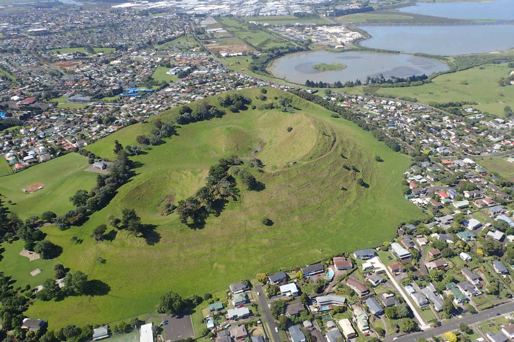
Te Pane-o-Mataaho / Māngere Mountain erupted 59,000 years ago from fire-fountaining eruptions forming a 105-metre-high scoria cone. It is one of the largest and best-preserved volcanic cones in the southern part of the Auckland Volcanic Field.
A second, smaller fountaining crater can be seen from the northern rim of the scoria cone, and a third U-shaped breached crater was present until it was quarried away in the 1950s-1960s.
Te Pane-o-Mataaho offers one of the finest panoramic views in the region. On a clear day, you can see the Waitakere and Coromandel ranges, the distinctive obelisk atop Maungakiekie One Tree Hill, and many other volcanic features scattered across the city.
The eruption produced a large amount of ash, and the plume was blown north-eastward by strong southwest winds. This thick blanket of volcanic ash covers lava flows from Maungakiekie, extending up to 5 kilometres to Penrose. Lava flowed from the base of the cone, forming an extensive 500-hectare lava flow field that now underlies the suburb of Māngere Bridge, extending west to Ambury Regional Park.
Te Pane-o-Mataaho is a particularly special volcano with its remarkably intact and complex crater. It has a 12-metre-high conical lava plug which solidified above the vent in the centre of the main crater. At the end of the fire-fountaining phase, the magma in the vent cooled to form a near-solid basalt plug, while still fluid magma remained in the plumbing beneath the volcano. Gas bubbles rising from the magma gradually built up considerable pressure under the plug and pushed the near-solidified lava out of the volcano’s throat. The escaping gas formed three small explosion craters around the northern side of the plug, which threw out blobs of molten lava and landed as spindled volcanic bombs, many of which still lay scattered around the small craters and the inner walls of the main crater.
Towards the end of the fire-fountaining eruptions, the main crater was breached to the east by lava flows, which rafted away scoria ramparts. Large volumes of lava flowed from the base of the cone, spreading across the flat surrounding plain to form a lava field of around 500 hectares. Some of this lava flowed into Māngere Lagoon, which had erupted shortly before in a closely related event.
Human history
The name ‘Māngere’ references Ngā Hau Māngere, or 'the idle breezes' observed by Taikehu of the Tainui canoe when he landed below the mountain six centuries ago. The name ‘Te Pane-o-Mataaho’ translates as 'the sacred head of Mataaho'. The name ‘Te Ara Pueru’ refers to a historic event that occurred on the maunga prior to European arrival and specifically applies to the largest north-eastern ridge, which has since been entirely quarried away. More information is available at the Tūpuna Maunga Authority website.
Māngere Lagoon
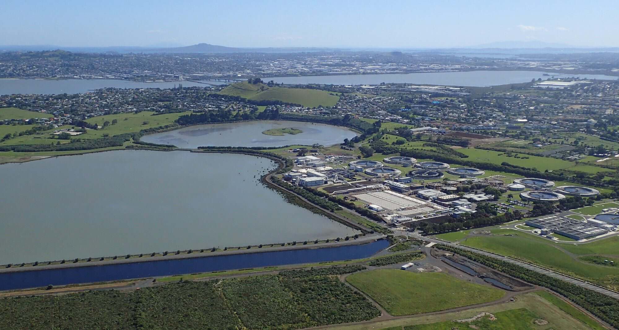
Māngere Lagoon erupted 59,500 years ago, 500 years before Te Pane-o-Mataaho Māngere Mountain, formed by steam-driven explosions as magma hit groundwater, creating the shallow, breached crater ring visible today. Lava from Te Pane-o-Mataaho’s subsequent eruptions filled up the valley between the mountain’s scoria cone and the lagoon’s tuff ring, with some of the lava spilling over the tuff ring into Māngere Lagoon’s crater. The fact that Te Pane-o-Mataaho’s lava overlies Māngere Lagoon’s crater rim tells us the two eruptions occurred in sequence, with Māngere Lagoon erupting first, making them a rare "coupled eruption".
Māngere Lagoon is a castle-and-moat type volcano, consisting of a small central scoria cone located in the centre of an explosion crater with surrounding tuff ring. This tuff ring was breached by rising sea level around 7500 years ago causing the crater floor to be infilled with marine mud brought in by tides. By human arrival, the whole 36 hectares of the crater was fully intertidal and fringed by salt marsh and partly colonised by mangroves.
Human history
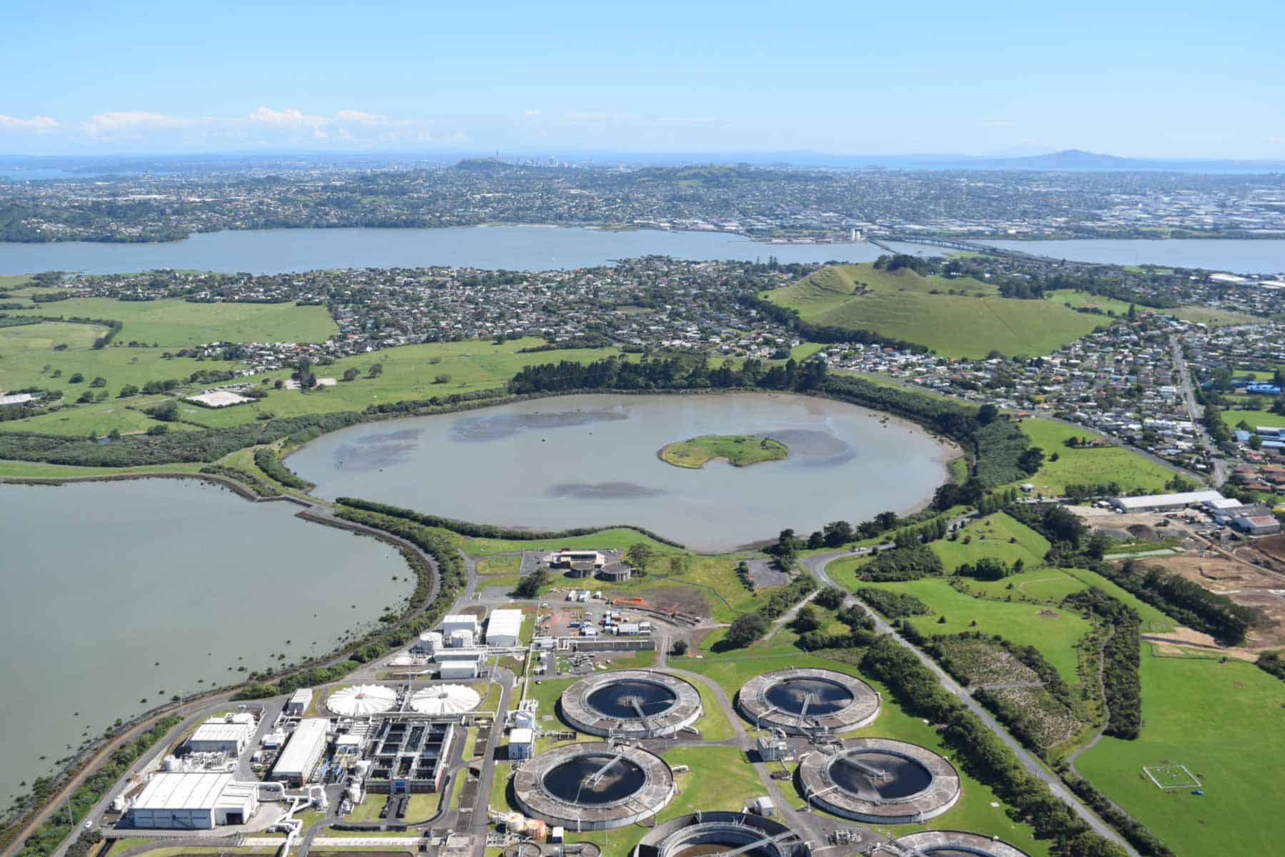
In the late 1950s, plans were proposed to build Tāmaki Makaurau’s new sewage treatment scheme on Motukorea / Browns Island. A public campaign led by mayoral candidate Sir Dove-Myer Robinson successfully protected the island and the Waitematā Harbour, resulting in the project being relocated to the Māngere foreshore instead, which, at the time, was less favoured and less populated. The decision dramatically reshaped the landscape. More than 500 hectares of tidal flats were converted into oxidation and sludge ponds, 13 km of coastline was modified, and two nearby volcanoes were extensively altered. The small scoria cone within Māngere Lagoon was levelled to form the hub of a network of embankments that divided the crater floor into sewage treatment ponds.
For almost 40 years, the lagoon served as a key part of Tāmaki Makaurau’s wastewater treatment system. In the 1990s, advances in land-based treatment technology made the ponds obsolete, leading to Aotearoa’s largest coastal restoration project. Between 1998 and 2005, the oxidation ponds were removed, and the lagoon was restored to a tidal environment.
Today, Māngere Lagoon once again functions as a tidal lagoon, with the scoria cone reconstructed to closely resemble its original shape. Although much of the volcanic landscape has been restored, evidence of its human modifications remains, including the main wastewater pipeline along the seaward edge of the lagoon.
Te Motu-a-Hiaroa / Puketūtū
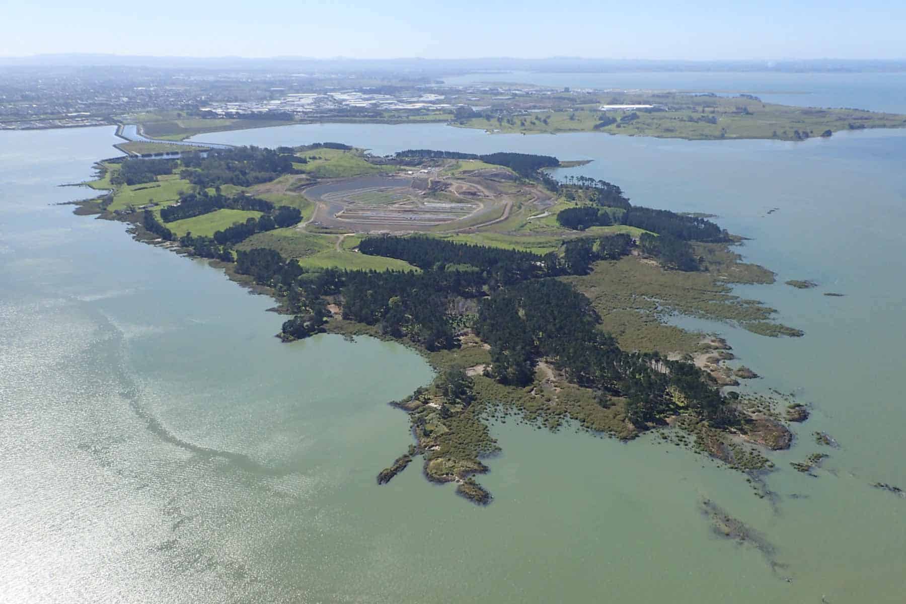
Te Motu-a-Hiaroa Puketūtū erupted 29,800 years ago and is the only volcanic island in the Manukau Harbour. However, when it erupted, the Manukau Harbour did not exist as the climate was much colder and the sea level considerably lower.
Like many other Tāmaki Makaurau Auckland volcanoes, Te Motu-a-Hiaroa Puketūtū began with wet explosive eruptions that threw up an 800-metre-wide tuff ring around its crater. Subsequent eruptions filled this crater, and only four short sections of tuff ring arc remain, forming smooth, gently sloping triangular hills on the island’s north and south sides. The main eruptions were fire-fountaining from several closely spaced vents that produced a central complex of scoria cones and mounds up to 65-metres-high. Towards the end of these fountaining eruptions, large volumes of lava flowed out from several vents between and around the lower parts of the crater, building up a thick apron of overlapping lava flows that completely surrounded the central cones, bursting through and overflowing the tuff ring in many places.
Rock exposed by the tides along the southern coast of the island provide insights into some of the volcanic processes. Exposures of bedded tuff at high tide level contain many projectile blocks of Waitematā Sandstone ripped from the walls of the volcano’s throat during wet explosive eruptions. Some sit in the original impact depressions that they made in the soft ash when they landed. Halfway along the south shore is a narrow, ribbon-like lava flow that has pushed its way into the soft sediment beneath a thin layer of volcanic ash. This intrusion heated up and baked the sediment in close contact with the flow, creating columnar-jointed, orange-coloured natural brick around it. As this flow pushed its way along, the sediment and tuff layers above it were pushed upwards, forming a geological fold called an anticline with a fracture at the top.
Human history
Te Motu-a-Hiaroa Puketūtū played a significant role in the history of the Tainui Canoe’s travels through Tāmaki Makaurau about 600 years ago. It was here that the canoe was hauled ashore to be repaired. ‘Te Motu-a-Hiaroa’ means ‘the island of Hiaroa’, who was the wife of Hoturoa, the commander of the Tainui Canoe.
Puketūtū means ‘hill of the tutu scrub’ and refers to the summit of a prominent triangular scoria peak which has now been quarried away. The largest cone remaining was named ‘Te Tautama-o-Rakataura’, meaning ‘the summit of Rakataura’, because Rakataura, the leading tōhunga on the Tainui, carried out ritual ceremonies on the summit to placate the spirits of the land and to ensure the safety of his people.
The island’s disused early European name was ‘Weekes Island’ after Henry Weekes, the first European owner (1848-49). John Logan Campbell also owned the island for many years (1852-1895). European owners farmed the land, building extensive dry stone basalt walls from the abundant rocks scattered across the ancient lava flows.
Up until 1958, Te Motu-a-Hiaroa Puketūtū was largely intact, with only a small quarry on the northeastern side of the cones. From 1958 to 2008, quarrying destroyed more than half the scoria cone complex, and most of the lava flows on the western and southern parts of the island were removed. The easternmost scoria cones and lava flows under the horse paddocks on the northeastern lava flow remain, although all the surface rock was long ago collected up and used to construct dry stone basalt walls.
The whole island is now owned by Te Motu-a-Hiaroa Charitable Trust who plan to build a marae on a small part of the northern side.
Moerangi / Waitomokia / Mt Gabriel
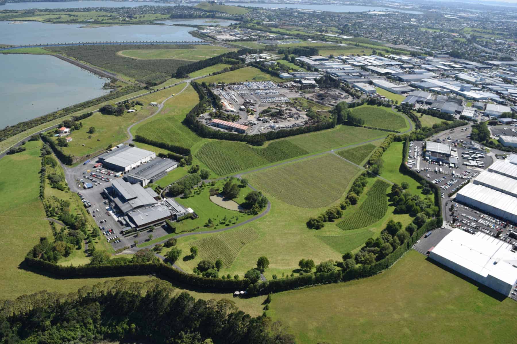
Moerangi Waitomokia Mt Gabriel erupted 20,300 years ago and was originally a fine example of a castle-and-moat volcano. It consists of an elliptical explosion crater, 700-1,000 metres across, surrounded by a 15-25-metre-high tuff ring with three small cones in the centre, produced by fiery explosive eruptions. Geophysical studies and coring found that dense basalt partly fills the explosion crater and appears to extend beneath the central cones, which are presumed to be a solidified lava lake.
The elongated crater was probably produced by two or more vents that erupted along a north-northeast-trending fault. Sections of tuff ring slumped back into the deep hole, creating the irregular scalloped outline of the crater. The northeastern crest of the tuff ring was pockmarked by a line of seven or eight small steam escape craters that presumably erupted late in the volcano’s history.
After the eruptions, the crater and its solidified lava lake were partly filled with water, becoming a freshwater swamp. Over thousands of years, decaying vegetation and sediment buried all traces of the underlying basaltic lava.
Human history
The name ‘Waitomokia’ means ‘water seeping into the ground’ and refers to the ponds in the crater that commonly dried up in summer. The small cones in the centre were known as ‘Moerangi’. Some longtime locals still know this volcano by its early European name, Mount Gabriel, after an early settler.
Pre-European Māori recognised the natural defensive advantages of building forts on the two conical cones in the swamp, which were extensively terraced with kūmara storage pits dug on the crest of the cratered cones.
The scoria cones were quarried in the late 1950s for use in the construction of the Māngere sewage treatment works across the road. Quarrying, roadworks and development around the crest of the tuff ring have removed most of its original detail. Villa Maria Estate winery is located in the southern half of the crater, and is sometimes used for public concerts on summer evenings.
Puketapapakanga-a-Hape / Pukeiti
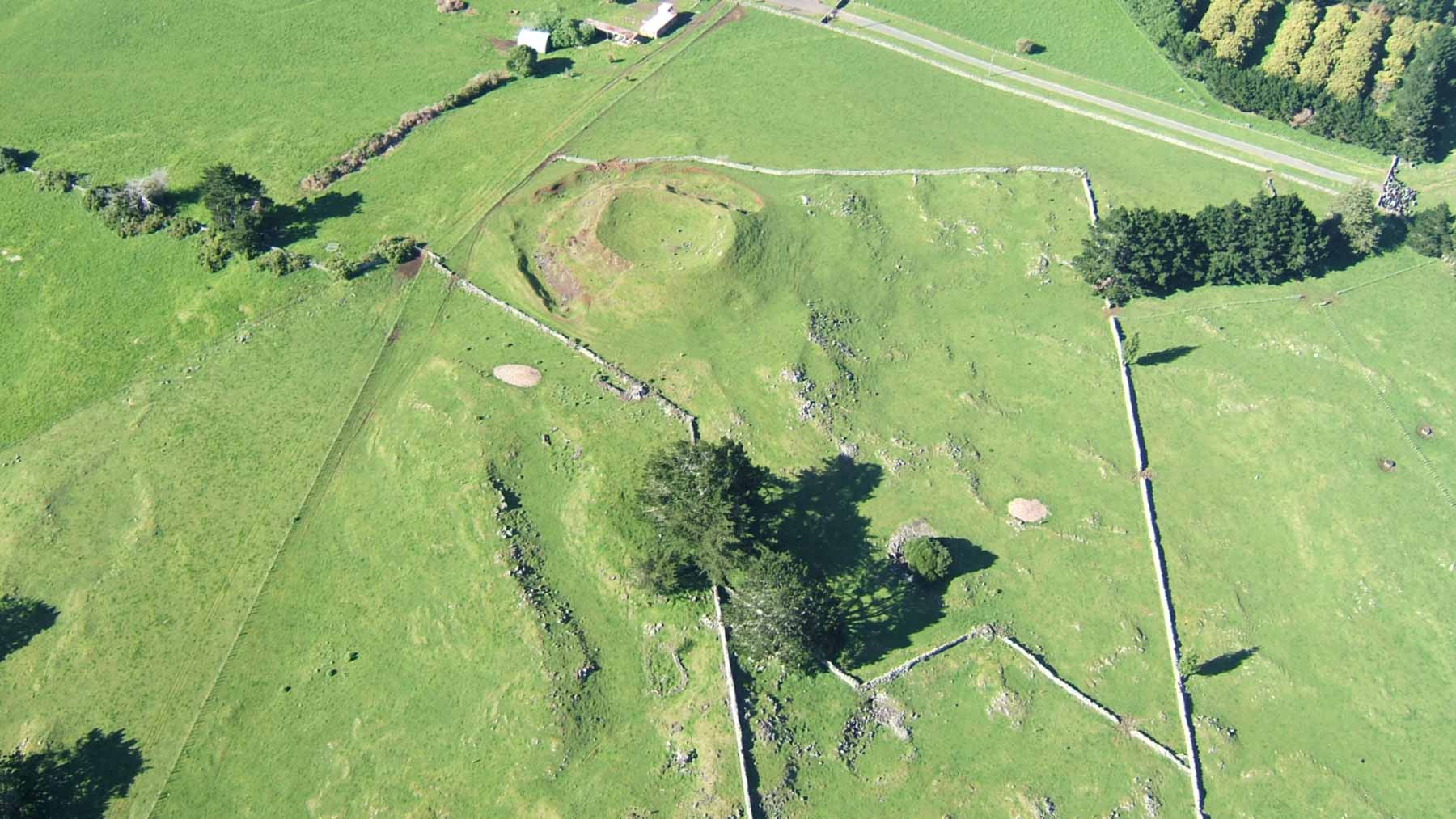
Puketapapakanga-a-Hape Pukeiti probably erupted 23,700 years ago and has a one-kilometre-wide, 800-metre-long fan of lava flows that spread northwards from a small vent over which a small, 10-metre-high scoria cone was built. This cone is the smallest remaining in the Auckland Volcanic Field and is different in composition from the larger scoria cones. Small quarry faces in its side show that it is made of rather dense basalt spatter that fountained out of the vent as voluminous lava poured out from around its northern base.
A small, dish-shaped crater still remains on the summit. Puketapapakanga-a-Hape Pukeiti’s lava flows are mantled in volcanic ash, unlike those from the nearby Ōtuataua Volcano.
Some of the lava flows also formed lava caves. There is a 90-metre-long lava cave with its roof still intact. It is known as Lino Lava Cave, as cavers placed a strip of lino on the floor to protect their knees from the sharpness of the basalt. Today, entry into this cave is prevented by a metal grill across the entrance.
Human history
This small cone has several te reo Māori names. Pukeiti means ‘small hill’, whereas Puketapapakanga-a-Hape refers to ‘the flat-topped hill where Hape arrived’. Hape was another name for Rakataura, the leading tohunga on the Tainui canoe when it visited Tāmaki Makaurau Auckland.
Ōtuataua
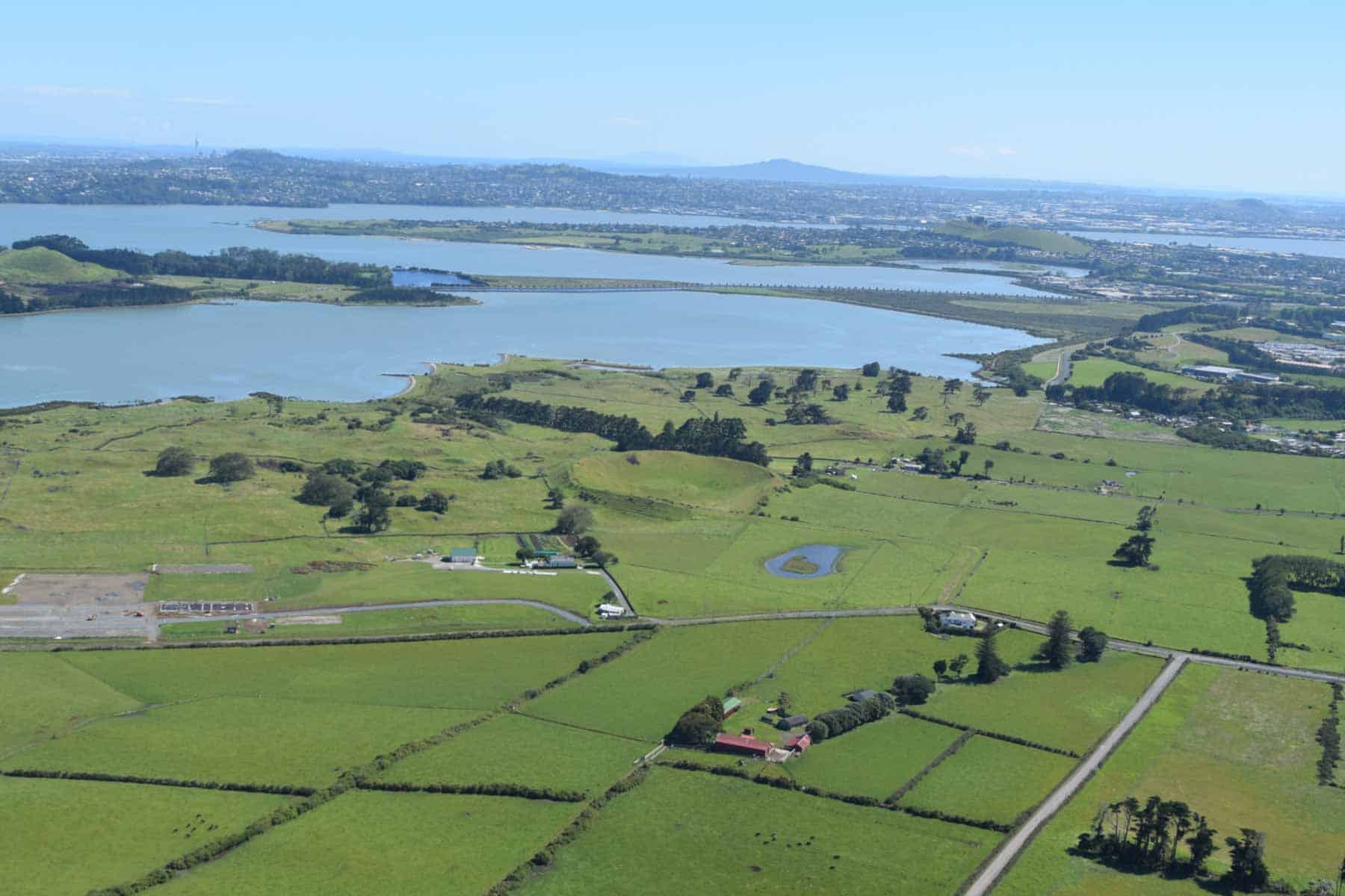
Ōtuataua erupted 24,200 years ago. The main phase of eruptions entailed fountaining from the single vent, which produced a 64-metre-high scoria cone. Lava poured around the western foot of the growing cone and breached the small summit crater, creating a horseshoe-shaped cone. The lava spread in a narrow 800-metre-long fan to the west and northwest, and today its toe forms the foreshore of the Manukau Harbour of the Ōtuataua Stonefields Historic Reserve.
The surface of these flows is rough, irregular and rocky. In places, there are trenches, lava flow rolls and small crevasses where congealed lava was left behind as more molten material flowed on.
Human history
The 100-hectare Ōtuataua Stonefields Historic Reserve is one of two remaining areas of lava flow fields that were extensively modified and used for gardening in pre-European times. Originally, over 8,000 hectares of Stonefields Garden were present in the Auckland Volcanic Field, but now less than 0.2% remains.
The former European name for Ōtuataua Volcano in the 1930s was Quarry Hill. Most of the scoria cone and some of the lava flows were quarried away in the 20th century. Some of the scoria was used in building the Auckland Airport runway and the causeway for the Northwestern Motorway between Waterview and Te Atatū.
In 1999, the rocky Ōtuataua and Pukeiti lava flow fields were purchased from their long-time European farming families to become a historic reserve, and the newly smoothed landscape was planted with grass.
Maungataketake / Elletts Mountain
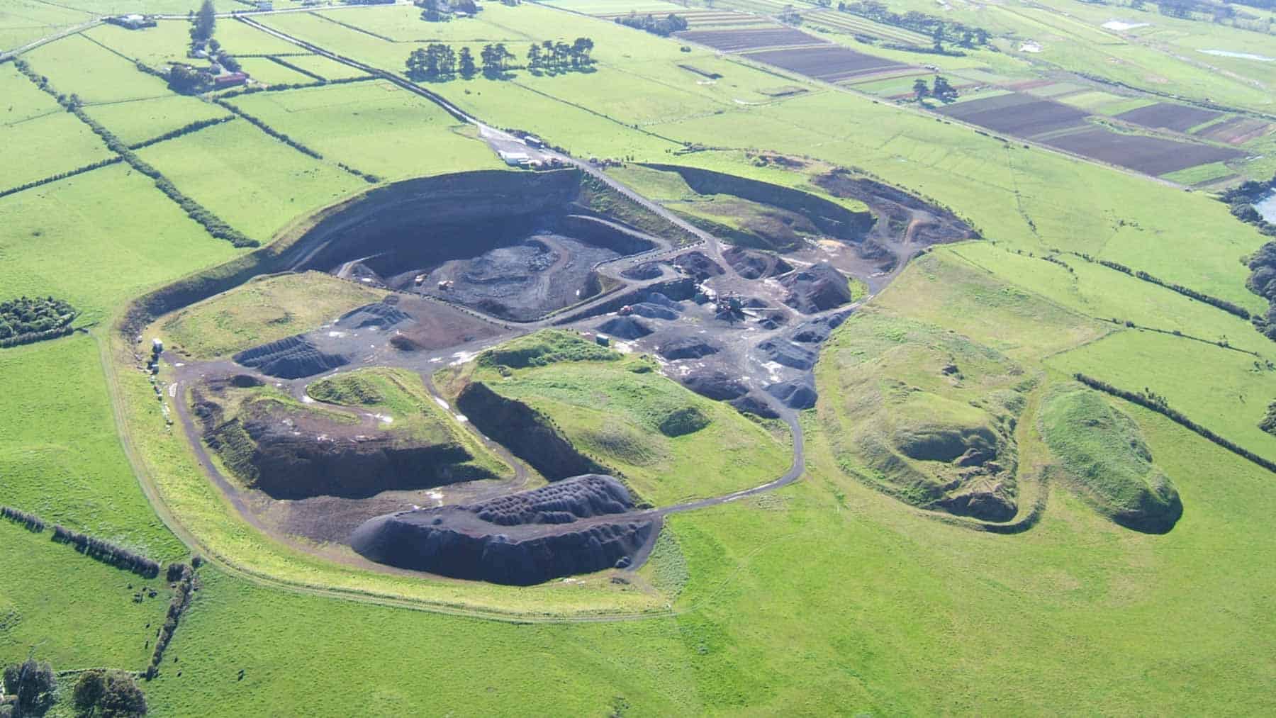
Maungataketake Elletts Mountain erupted 88,900 years ago and exhibited all three eruption styles. It initially erupted with a dramatic series of wet explosive eruptions as rising magma collided with groundwater, forming an 800-metre-wide crater surrounded by a low tuff ring. At the base of the tuff ring sequence are the remains of a mixed podocarp forest of rimu, kauri, miro, hinau, and tanekaha, that was killed and buried by the early phases of the eruption. Magma continued to rise after the groundwater source was exhausted, transitioning the style to dry fire-fountaining eruptions of frothy scoria. This built two scoria peaks, up to 70-metres high. Lava also flowed out from the base of the cones, forming a thick flow that did not escape the explosion crater and encircled the scoria cones on all but the north side.
The beach exposures at Maungataketake offer something unique in all of Auckland: you can actually walk along a cross-section of volcanic deposits from close to the vent all the way out to their furthest extent, watching the layers thin and become more fine-grained over roughly a kilometre. Studies of these deposits have shed light on the violence of the eruption’s fast-moving base surges of hot gas and ash. Travelling at up to 65 metres per second, they snapped trees half a metre thick nearly a kilometre from the vent.
The foreshore at Maungataketake also holds a second, even older secret beneath the volcanic layers. Around 100,000-200,000 years ago, when sea levels were lower, a vast kauri forest grew across what is now the tidal mudflats of the Manukau Harbour. These ancient trees grew up to two metres in diameter and stood over 30 metres tall. As the sea gradually encroached, the forest gave way to a peat swamp, and the fallen trees were preserved remarkably intact in the waterlogged ground and were later also buried beneath Maungataketake’s volcanic deposits. Today, as those deposits erode away at low tide, the giant stumps and trunks are re-emerging from the mud, their orientation still showing they were toppled by strong south-westerly winds tens of thousands of years ago. Together with the younger podocarp forest buried and killed during Maungataketake’s eruptions, these kauri remains collectively form the ‘Ihumatao Fossil Forests’.
Human history
Maungataketake is the te reo Māori word for ‘everlasting mountain’, which unfortunately and ironically, it is not. All that is left of the scoria cone today is a giant hole in the ground. The cones were extensively terraced by pre-European Māori, and the highest peak was the most heavily defended as a fortified pā. The European name for this volcano comes from the long-time owners, the Ellett family. As the supply of scoria to the growing city began to run out from closer sources, quarrying began at Maungataketake in 1962. By the 1990s, the scoria cones were flattened, and the land is now zoned for an industrial subdivision.