
Pupuke Moana
At around 193,000 years old, Lake Pupuke (“to well up, rise, increase in volume”) in Takapuna is the oldest volcano in the Auckland Volcanic Field. What looks like a peaceful lake a stone’s throw from the beach is in fact a flooded explosion crater. Unlike most Auckland volcanoes, which begin with explosive steam-driven eruptions before settling into quieter lava-producing phases, Pupuke did the opposite: it began with lava flows, which dammed a nearby stream and allowed water to pond and eventually flood back into the active vents. This then triggered a dramatic shift to violent steam-driven explosions.
The sources of these lava flows are thought to be two vents; one larger in the centre of the now-lake, and another vent to the north-east. The two vents are thought to be the centres of two circular explosion craters that can be picked out in the aerial view of Lake Pupuke. Base surges and ash fall built up a gently sloping tuff ring around Lake Pupuke that sits atop the lava flows. You might be able to spot layered ash deposits in road cuttings along Northcote Road.
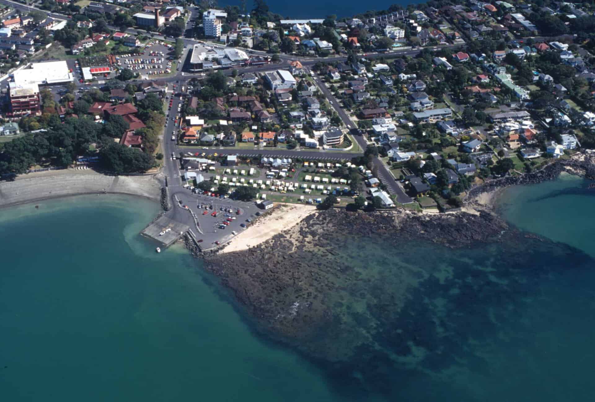
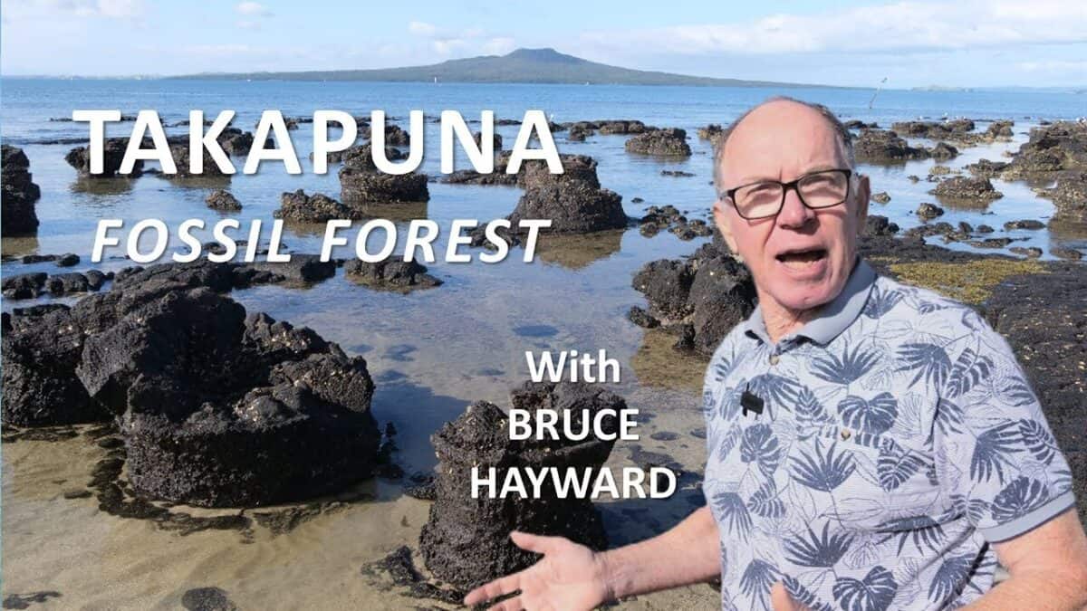
Just a short walk away at Takapuna Beach, another relic of Pupuke’s eruption is preserved in the rocky reef exposed at low tide. When lava flows from the volcano swept across the coastal forest around 193,000 years ago, the molten rock engulfed the trees, setting them alight but preserving their shapes as it cooled and solidified around them. The result is a reef riddled with lava tree moulds, hollow impressions of trunks, branches, bark texture, and wood grain, frozen in basalt. At low tide, more than 100 vertical tree trunk moulds are visible, the largest reaching one and a half metres across.
Human history
Hochstetter (1864) was the first to describe Lake Pupuke and its volcanic origins. His writings are the source of the oft-quoted myth that the water in Lake Pupuke comes through an underground aquifer from Rangitoto. These days we know that this is impossible and that all the lake water is purely derived from rain that falls on the lake and the surrounding inside of the tuff ring which slopes towards it. The clear fresh water of the lake was used to provide the first reticulated water supply for Devonport Borough from 1894. The old brick pumphouse in Killarney Park housed steam engines that pumped water to a reservoir on Mt Victoria. For a time, Lake Pupuke also supplied water to Northcote and Birkenhead boroughs.
Te Kopua o Matakamokamo / Tank Farm
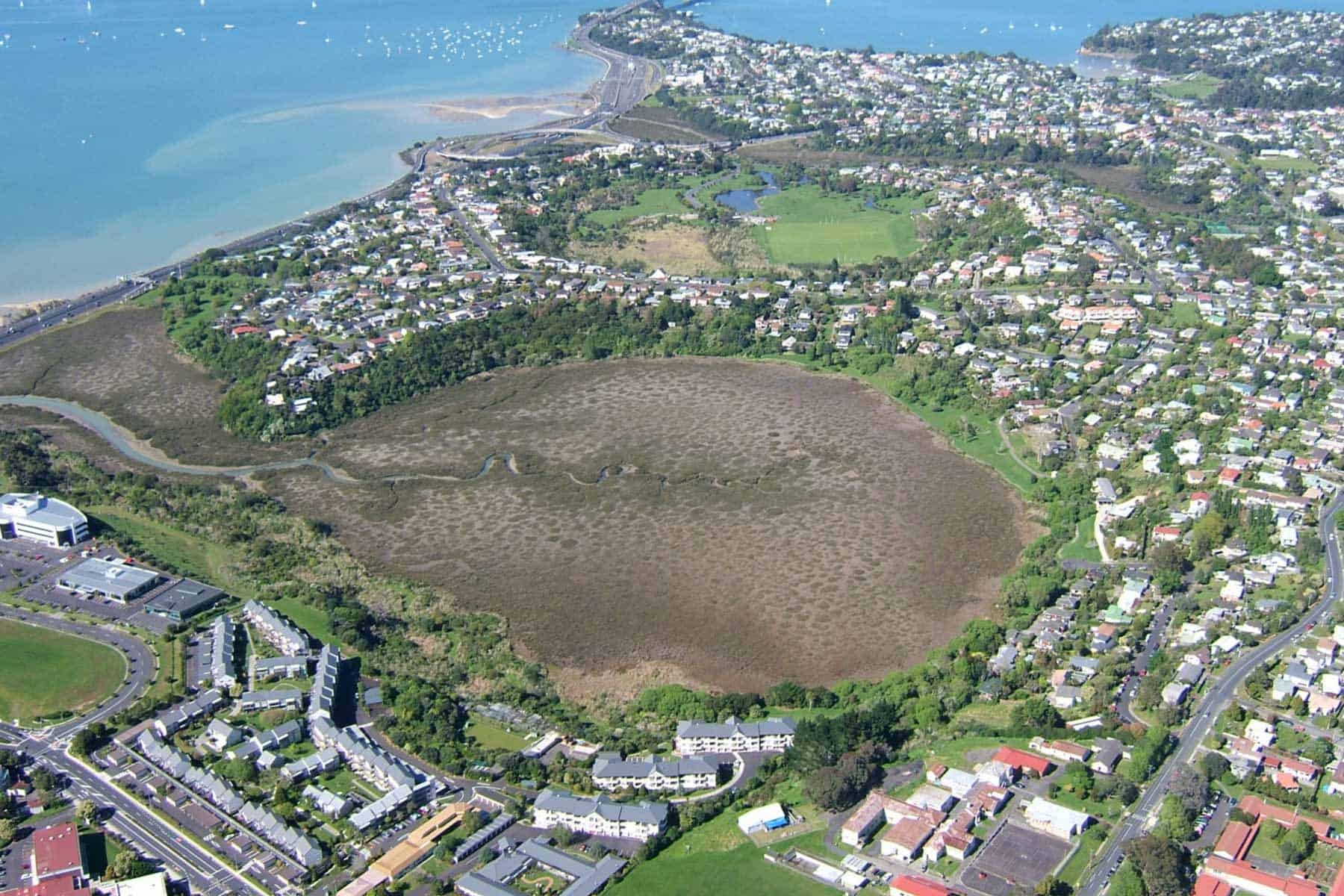
Te Kopua o Matakamokamo / Tank Farm was formed by explosive eruptions just after the neighbouring Onepoto Crater, about 180,000 years ago.
After its eruption the crater became a freshwater lake surrounded by a tuff ring that was breached by rising sea level about 7500 years ago after the end of the Last Ice Age. It filled up with marine mud to become a tidal lagoon. Unlike many of Auckland’s breached explosion craters, it still contains its original pre-human mangrove forest with a narrow fringe of salt marsh.
Human history
Te Kopua o Matakamokamo means ‘the basin of Matakamokamo’.
The crater was named Tank Farm during World War II after the fuel storage tanks that were dug into the north wall of the explosion crater to camouflage them from potential aerial attack.
A portion of the tuff ring, where The Warehouse’s head office now stands, was removed to provide fill during construction of the Northern Motorway.
Onepoto
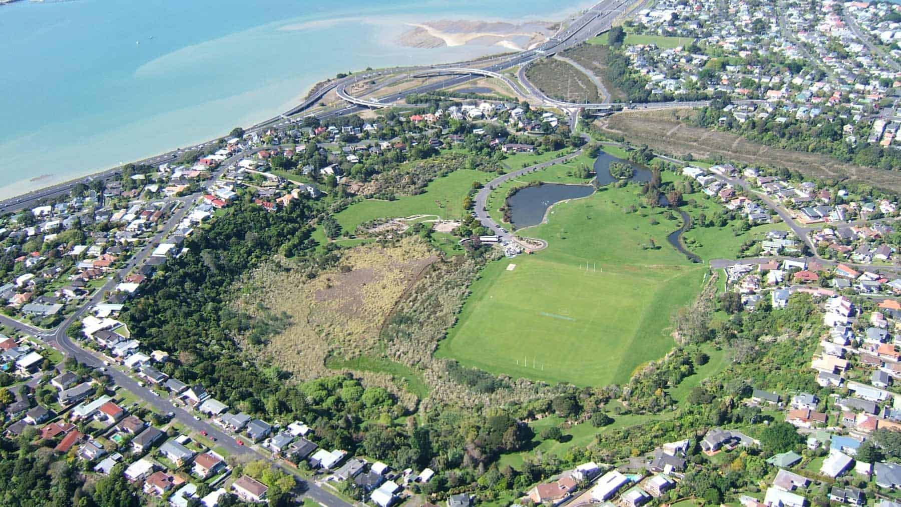
Onepoto erupted about 185,000 years ago. The explosion created a 600-metre-wide crater and high surrounding tuff ring on what had been the site of a mature kauri forest. After the eruption the crater filled with freshwater and became a lake until part of the ring was eroded about 8,100 years ago. The crater then became an inter-tidal salt-water lagoon.
Human history
Onepoto means ‘the short beach’ in te reo Māori. It was also called Te Kopua-o-Matakerepo in the story of Te Riri a Mataaho.
Hollow moulds of some of the kauri killed and buried by volcanic ash were uncovered when the southwestern portion of the tuff ring was removed in the 1950s to provide fill for the northern approach to the harbour bridge.
In 1975, the council filled in the basin and turned it into playing fields with a couple of artificial ponds. It is the home of the Aussie League North Shore Tigers and the NZ radio Yacht Squadron races model sail boats on one of the ponds.