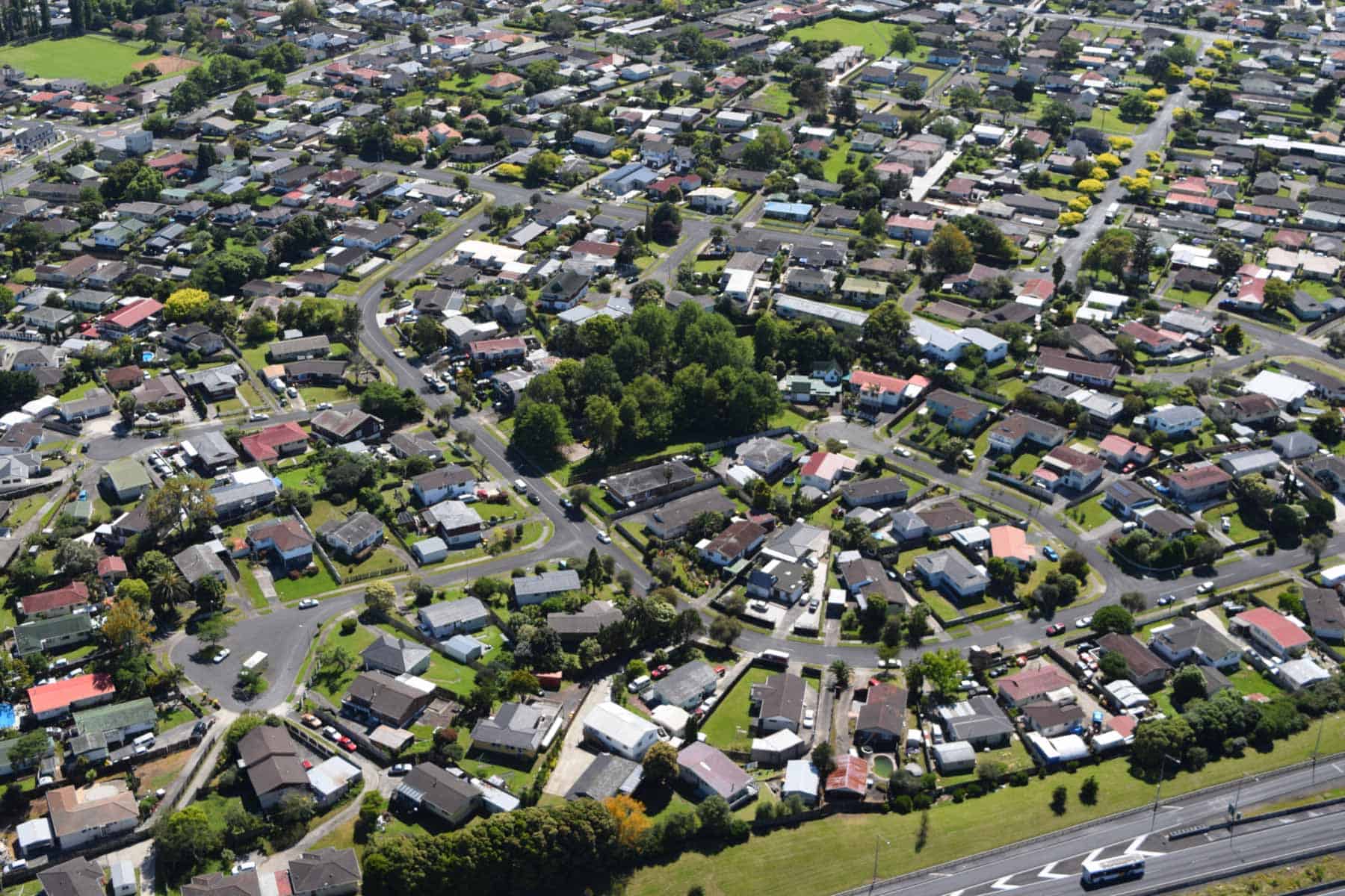
Mt Robertson / Sturges Park
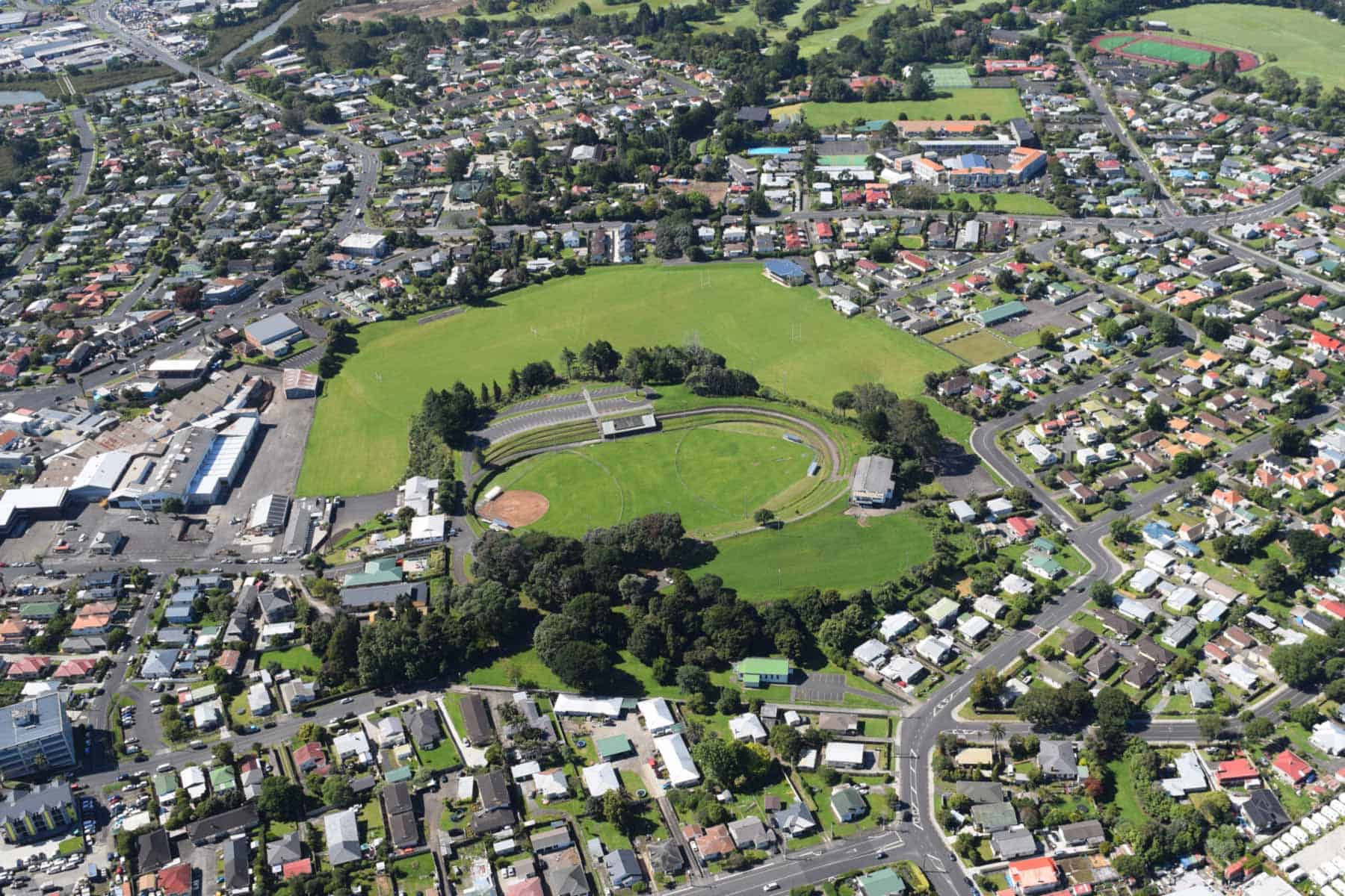
This volcano erupted 24,260 years ago and is located in the centre of Ōtāhuhu and is one of the less conspicuous of Tāmaki Makaurau Auckland’s volcanoes. It is a classic castle-and-moat volcano with a simple scoria cone in the centre of an 800-metre-diameter explosion crater, with a 12-metre-high tuff ring arc along the south and east sides.
The low scoria cone was around 28-metres-high and had a 200-metre-wide shallow crater. Both the scoria cone crater and the moat beneath the cone and tuff ring became freshwater swamps that were partly filled with accumulated peat and silt after the volcano’s eruption.
Human history
The te reo Māori name for this volcano and pā is not known. Before the New Zealand Wars, it was known as Fort Richards after Lieutenant Richards, who set up a defensive lookout here during early racial war scares in the 1840s.
In the late 1850s, Ferdinand von Hochstetter named it after local landowner Robert Robertson. Sturges Park was named after Alfred Sturges, the mayor of Ōtāhuhu who donated the land to be a park in 1912. Like many other Tāmaki Makaurau volcanoes, Mount Robertson had a well and pump house that helped supply the population with water until the early 1950s.
The scoria cone’s crater has been enlarged and the floor raised with fill to form the sports stadium of today. The crest of the scoria cone used to be 5 metres higher on both the north and south sides, but the top was taken off by quarrying in the 1950s and 1960s to produce a flat playing field next to the rugby clubhouse and the wide car park on the south side of the crater. This is where concrete reservoirs once stood.
Parts of Great South and Māngere Roads run along the tuff ring crest, and Ōtāhuhu College is built on the gentle outer slopes of the tuff ring to the south. The swampy moat has been drained and turned into playing fields used by Ōtāhuhu College.
Boggust Park Crater
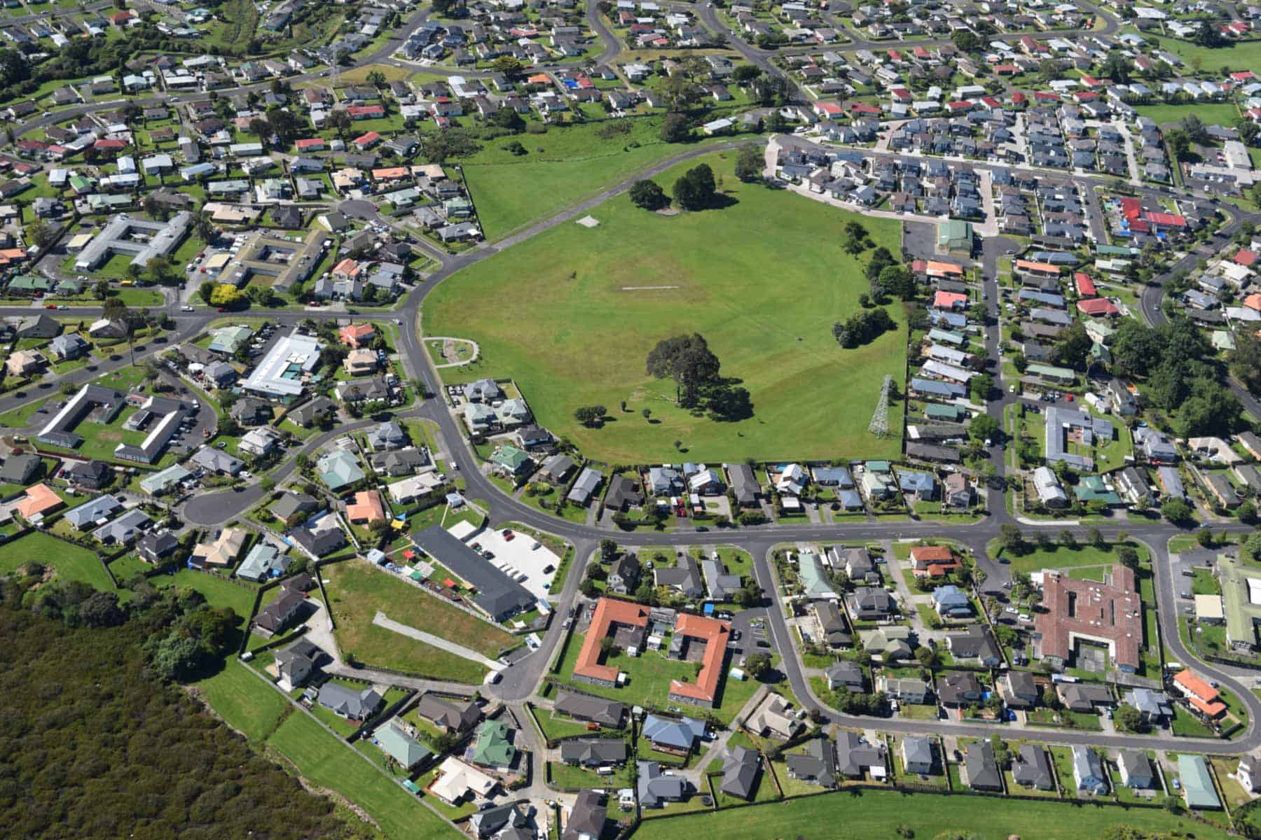
Boggust Park Crater erupted at least 130,000 years ago and was first recognised as a volcano in 2011. It has a 300-400 metre-diameter crater, surrounded on three sides by a 6-8 metre-high semi-circular tuff ring, with steep inner slopes and gentler outer slopes.
Today, the floor of the crater is about 5 metres above high tide level, and it slopes down to the edge of Harania Creek Estuary on the Manukau Harbour. After the eruption, Boggust Park Crater became a freshwater lake before it was breached by the sea to become an intertidal lagoon for a few thousand years. The crater became a swampy depression until 1 metre of fill was added and drainage installed turning it into a recreational sports field.
Human history
No te reo Māori name for this feature is known. Boggust Park Crater is named after the park in which it is located. The park is named after Ralph Boggust, former superintendent of the Manukau Parks Department.
In 1958, a major wastewater pipe from southeast Tāmaki Makaurau Auckland to Māngere Sewage Treatment Plant was buried across the middle of the explosion crater.
From 1966 to the early 1990s, the crater was in the middle of the Māngere Hospital psychopaedic facilities. Residential subdivision reached this area in the 1990s. The crest of the tuff ring was flattened off by bulldozing, and the bowl-shaped crater was set aside as a public reserve.
Te Pūkaki Tapu-o-Poutukeka / Pūkaki Lagoon
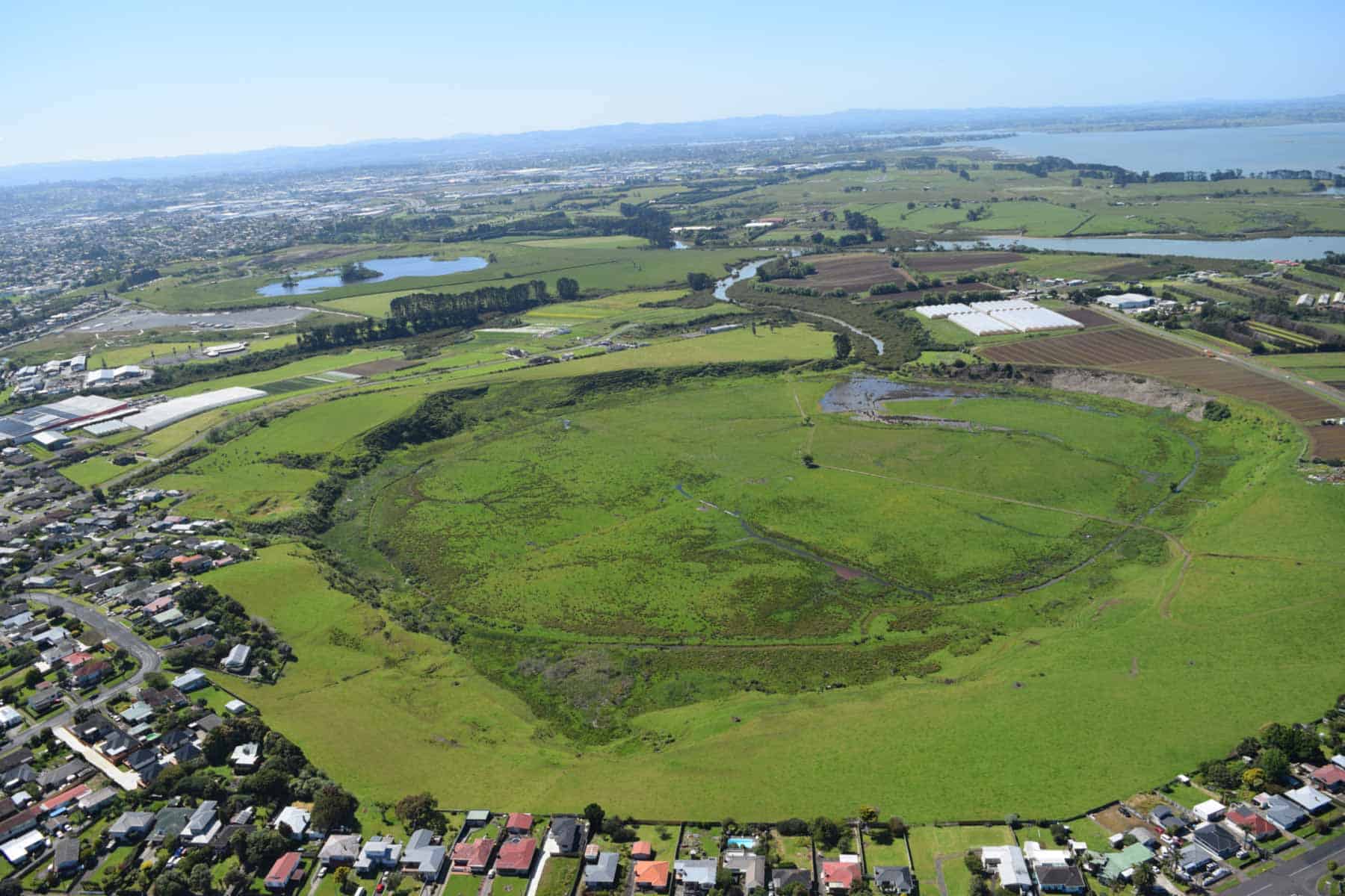
Te Pūkaki Tapu-o-Poutukeka Pūkaki Lagoon is one of the best preserved of the explosion craters and surrounding tuff rings in the Auckland Volcanic Field. It was formed at least 45,000 years ago, when the climate was cooler than today, and the sea level was lower. Pulsating wet explosive eruptions and base surges resulting from the interaction of rising molten magma with cold groundwater created a 100-metre-deep, 500-metre-diameter crater surrounded by a 20-40 metre-high tuff ring.
The ash is weathered to a rich red soil that, in places, is used for horticulture. Magma supply stopped before all groundwater was exhausted, and no fire-fountaining or lava flow eruptions occurred. Following the eruptions, the explosion crater filled with fresh water, forming a lake. No streams flowed into the lake, and little soil or sand washed into it. The main component of the sediment that slowly accumulated on its floor was the siliceous shells of diatoms (phytoplankton).
Every so often, volcanic ash from a distant eruption landed in the lake and sank to form a distinctive layer on its floor. Coring of the sediment has revealed the presence of at least 14 black basaltic ash layers from nearby Tāmaki Makaurau Auckland volcanoes; 25 lighter grey, thin andesitic ash layers erupted from Ruapehu, Tongariro and Taranaki volcanoes; and 16 cream to white rhyolitic ash layers erupted from the Taupō and Ōkotaina caldera volcanoes. Much of the 1.5 metre thickness of basaltic ash encountered at 56 to 58 metres below the surface probably came from adjacent Crater Hill’s eruption about 30,400 years ago.
The lake sediment also contains abundant fossil pollen and spores that record the changing vegetation of the surrounding Manukau lowlands as the climate fluctuated during the Last Ice Age cycle.
The crater was breached 8,000 years ago, when the lake was still around 30 metres deep, and a deep saltwater lagoon was initially created. Every time the tide came in it carried, suspended mud which sank once inside the quiet lagoon, quickly filling the crater with 25 metres of marine mud. By 6,000 years ago, Pūkaki had become entirely tidal mudflats, which gradually accumulated more sediment that became colonised by a salt marsh and mangroves around the fringes.
Human history
The name for this volcano is a shortened version of Te Pūkaki Tapu-o-Poutukeka, meaning ‘the sacred fountainhead of Poutūkeka’, an important spring at the head of the lagoon.
Ferdinand von Hochstetter marked a small scoria cone inside Pūkaki Lagoon Crater on his 1864 map, but this was a mistake, and he may have been confused with Crater Hill next door.
In the late 1920s, the tidal inlet was dammed, and the lagoon floor was transformed into farmland and the Henning’s Māngere Speedway. Ownership of this reclaimed lagoon floor was returned to local iwi in the 1990s. Most of the farmed inside slopes of the crater were purchased for a public reserve by the Manukau City Council in 2008.
Crater Hill
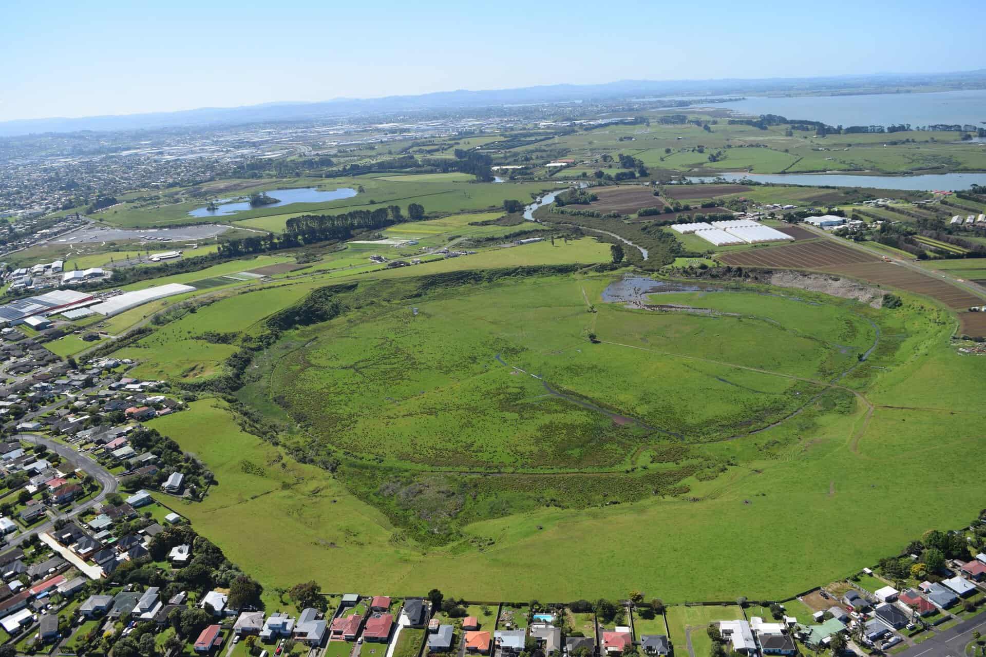
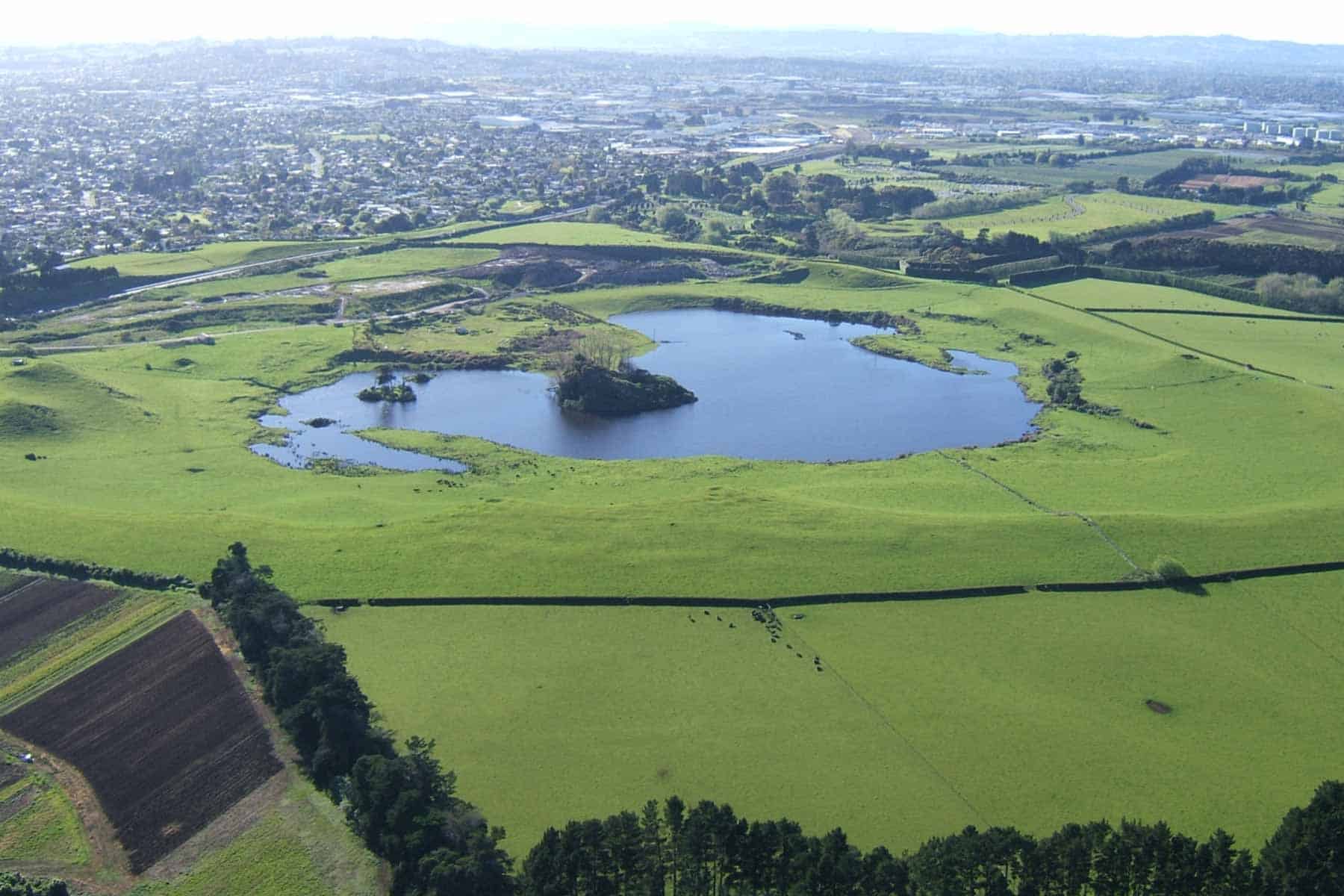
Crater Hill volcano erupted about 30,400 years ago and is named for its spectacular circular crater. Early eruptions were of the wet explosive style, throwing out large volumes of pulverised wet ash, interspersed with fine scoria from localised fire fountains from a second vent.
Together, these built up a 25-35 metre high, 800-metre-diameter tuff ring. The highest point is 40 metres above sea level. The tuff ring’s crest is scalloped on the inside, probably from where wet ash slid back into the crater as the ring was still forming.
Once the groundwater supply was exhausted, lava welled up in the crater, forming a lava lake. The surface of the lake cooled and crusted over while staying molten underneath. A little later, the lava partly withdrew back down the volcano’s throat, and the thin, solid basalt crust of the lake was sucked back with it. As the lava withdrew, the basalt crust along the inside edge of the tuff ring was left behind, like the dirty ring around the inside of a bath when the water is let go. The crust began to reform, but there was another phase of withdrawal, and a second, lower ring of basalt was left.
As the lava drained from the collapsing basalt crust, it piled up into a mountain of broken basalt blocks in the centre of the crater. This heap forms an island in the middle of the present-day freshwater lake. In two locations on the southern side of the explosion crater, molten lava flowed out from beneath a thicker basalt crust along the lake’s periphery, forming several unusual lava caves.
During the time of the lava lake, fiery, explosive eruptions broke out on its eastern edge, building a sizeable 25-metre-high scoria cone on the cooled, solid basalt crust of the lake’s surface.
Human history
No te reo Māori name survives for this volcano, although in the last few years, the collective name for all the crater volcanoes in this vicinity, Ngā Kapua Kohuora, has been applied to Crater Hill.
The inner crater, and outer slopes of the tuff ring, were extensively cultivated in pre-European times, and house sites are known on the tuff ring crest, and inside the shelter of the large crater and near the freshwater lake. This would have been a strategically important site, because it was close to one of the major canoe portages between the Manukau and Waitematā harbours.
The two best lava caves inside the crater are known as Self’s Lava Cave, named after the family who has owned this property since the 1920s, and Underground Press Lava Cave, which is reputed to have been used for clandestine subversive publishing during the Second World War.
Today, the ephemeral freshwater lake in the bottom of the crater is present in winter, and almost dry in summer. This lake is a water reserve and was used as a supply of fresh water for Dominion Breweries in Papatoetoe for many years from the 1930s.
The near central scoria cone was quarried down to a flat stump in the 1940s and 1950s. The scoria-rich tuff ring in the east was also extensively quarried during the later part of the 20th century because of its high scoria content. In the last decade or so, the large tuff ring quarry has been refilled with clean fill, approximately restoring the original shape.
Kohuora Crater
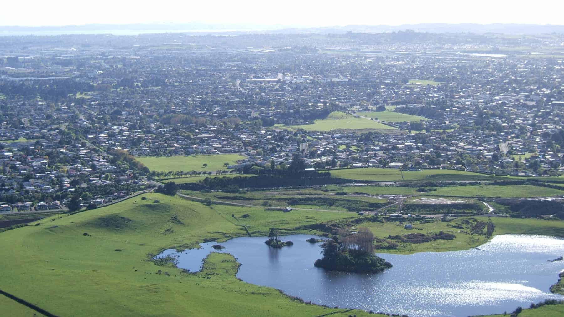
Kohuora Crater erupted 33,170 years ago. It is an L-shaped crater produced by wet explosive eruptions from four or more vents as rising magma interacted with groundwater. As a result, this is one of the few explosion crater volcanoes in Tāmaki Makaurau Auckland that doesn’t have a simple circular shape. The explosive eruptions threw out vast quantities of pulverised light-coloured pumiceous silt and Waitematā Sandstone, which underlies much of the Manukau lowlands, and lesser amounts of darker volcanic ash. This built up an encircling rim of bedded tuff 15-25 metres high around the vents.
Kohuora Crater’s tuff ring and crater were mantled by dark, scoriaceous ash blown from nearby Crater Hill when it erupted about 3,000 years later.
Probably the youngest of the explosion crater vents was in the southwest corner and occupies the low circular depression of Beaufort Reserve. Some of the ash thrown out from there forms the lowland now underlying the houses in Beaufort Place. Originally, Kohuora Crater’s complex crater was much deeper than it is today, but after its formation, it became a lake that accumulated substantial sediment.
Human history
By the time of human arrival, the floor of Kohuora Crater was a wetland swamp. Kohuora is the te reo Māori name for this unusual volcano and refers to the mist that sometimes fills the crater, providing life-giving moisture.
Both Charles Heaphey and Ferdinand von Hochstetter recognised that this was of volcanic origin. Hochstetter also erroneously thought that nearby, less prominent depressions were also craters. He labelled them ‘the five craters of Kohuora’, although today the name applies only to this one.
Kohuora Crater has not been modified by any quarrying, but much of the crater floor wetland has been filled with refuse and clay and drained.
The eastern lobe of the crater is Kohuora Reserve and Papatoetoe Rugby League Club playing fields. Much of the remaining unfilled wetland is set aside as Beaufort and Leidenfeld Reserves.
Cemetery Crater
Cemetery Crater is located 1 kilometre southeast of Crater Hill and 1 kilometre south of Kohuora Crater. It was a shallow 200-metre-diameter explosion crater surrounded by a 10-metre-high tuff ring, which in the southwest has been breached by a stream. It was first recognised in the 1960s by geologist Ernie Searle, who named it after the nearby Manukau Memorial Gardens Cemetery. Since then, the two have been separated by the construction of the Southwestern Motorway.
At the time of residential subdivision, the tuff ring and crater were re-contoured to make more gently sloping sections. There are no rock exposures to be seen, and we do not know when this volcano erupted.