
Rarotonga / Mt Smart
Rarotonga / Mount Smart erupted 20,000 years ago through the southeast edge of the Maungakiekie / One Tree Hill lava flow field. Initial wet explosive eruptions were followed by major fountaining that built an 87-metre-high scoria cone with a small central summit crater. Lava flowed out from the base of the cone and spread east and south, with the ‘toe’ of some of the flows forming the foreshore of Manukau Harbour.
Human history
The maunga has at least two te reo Māori names, Rarotonga, meaning the Lower South, a name brought from Hawaiki the ancestral homeland and Te Upu Kura a Maki, meaning ‘the Red Bowl of Maki’.
Prior to the arrival of Europeans, the scoria cone was extensively terraced and used as a defensive pā by local Māori. More information is available at the Tūpuna Maunga Authority website.
The European name of Mount Smart is after Henry Dalton Smart, a lieutenant in the New Zealand Mounted Police.
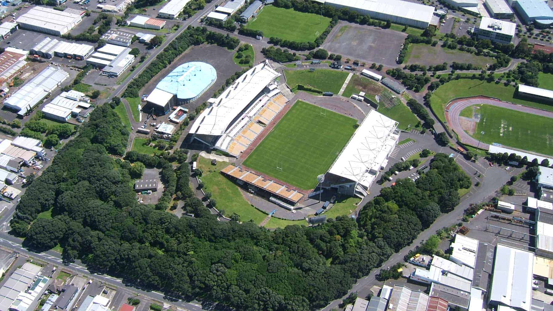
The earliest quarrying was for ballast for Auckland’s early rail lines. From 1865 to the 1960s, New Zealand Railways excavated the scoria and transported it away in rail wagons along a branch railway line. Pōhutukawa were planted in the 1940s on the lower slopes and hint at the original size of what was a substantial cone.
A sports stadium was opened in the floor of the old quarry in 1967 and used as the main stadium for the 1990 Commonwealth Games. Today, Mount Smart Stadium is home to the New Zealand Warriors rugby league team, and the Big Day Out Music Festival, as well as many other large music and cultural events.
Maungarei / Mt Wellington
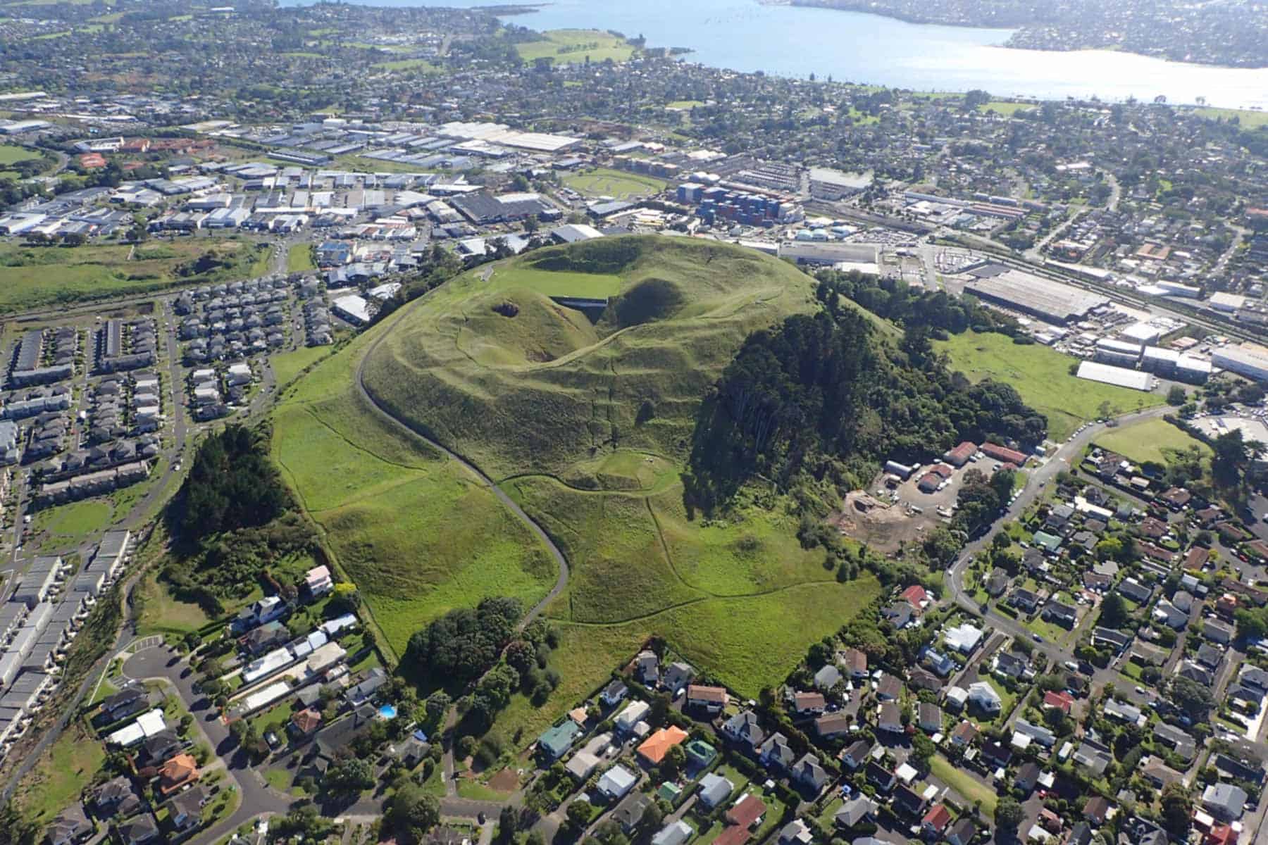
Located in the eastern part of the Auckland Volcanic Field near the shores of the Tāmaki Estuary, Maungarei stands 100 m tall. At 10,000 years old, it is the second youngest volcano in the AVF (behind Rangitoto). Fire-fountaining eruptions produced a large scoria cone with an almost perfectly circular base and a flattish summit, with three overlapping craters. A 16-metre-deep surge chamber, known as Te Rua-a-Pōtaka, funnelled swirling lava into western flows. These filled a deep valley before topography channelled them across Ellerslie toward Penrose.
Maungarei erupted right after Te Tauoma / Purchas Hill, a tiny volcano less than 500m north that is now mostly destroyed by quarrying. Because they were so close in time and space, geologists believe they form a pair that shared the same magma conduit to the surface.
Human history
Maungarei means ‘the watchful mountain’. The eastern side of the cone is covered in terraced house sites and food storage pits that attest to the Māori fortification of the maunga. More information is available at the Tūpuna Maunga Authority website.
The quarry located on the lava flows to the northwest of Maungarei was once the largest aggregate quarry in Aotearoa New Zealand, throughout the late 20th century, before its closure in 2008. The vast pit formed by this quarry has since transformed into the residential suburb of Stonefields.
The slopes of Maungarei were the only known home of Tokea orthostichon, the first native earthworm formally named in the Australasian region (in 1861). Unfortunately, recent searches found no trace of it, and the species is now presumed extinct.
Te Kopua Kai-a-Hiku / Panmure Basin
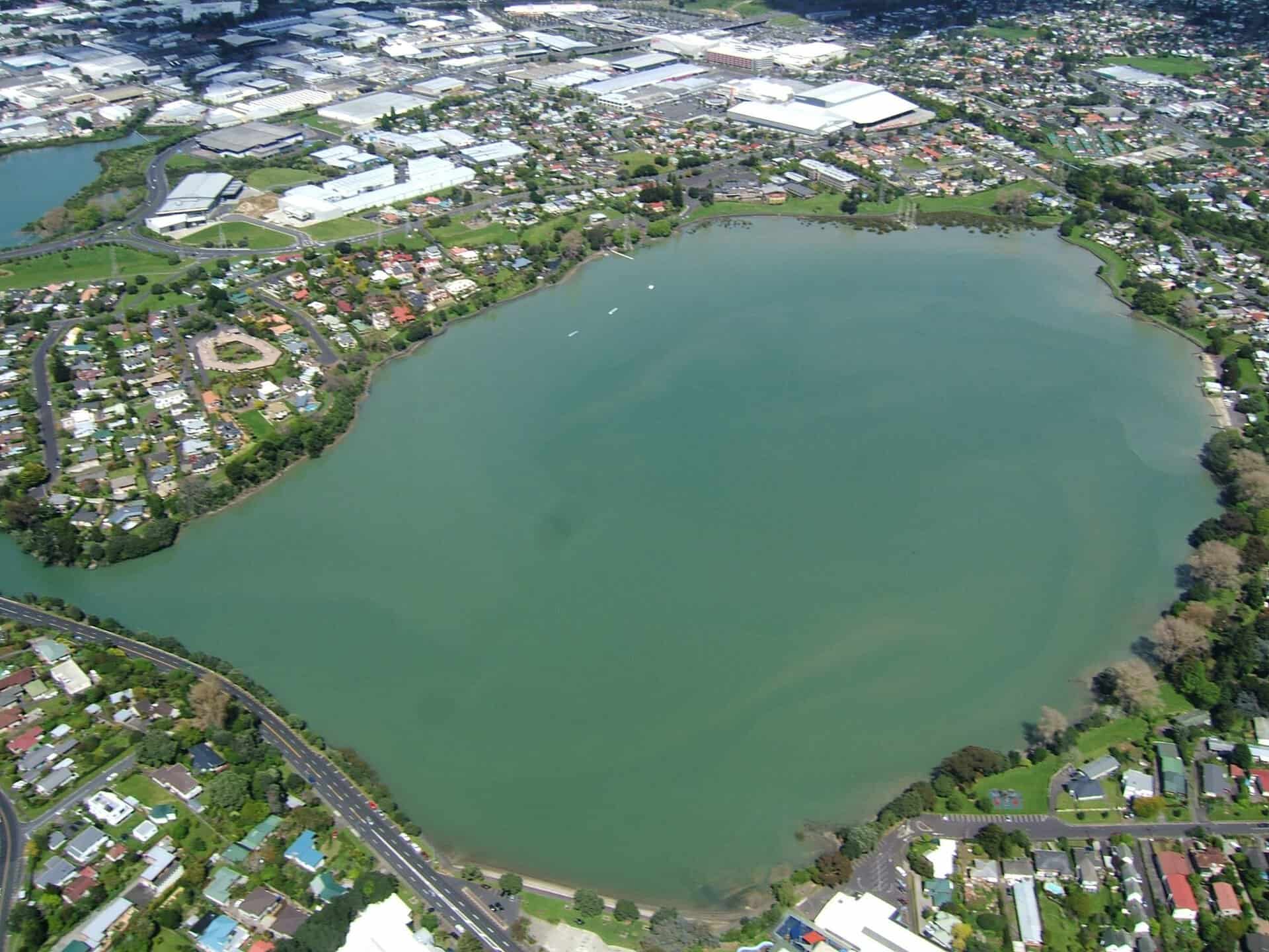
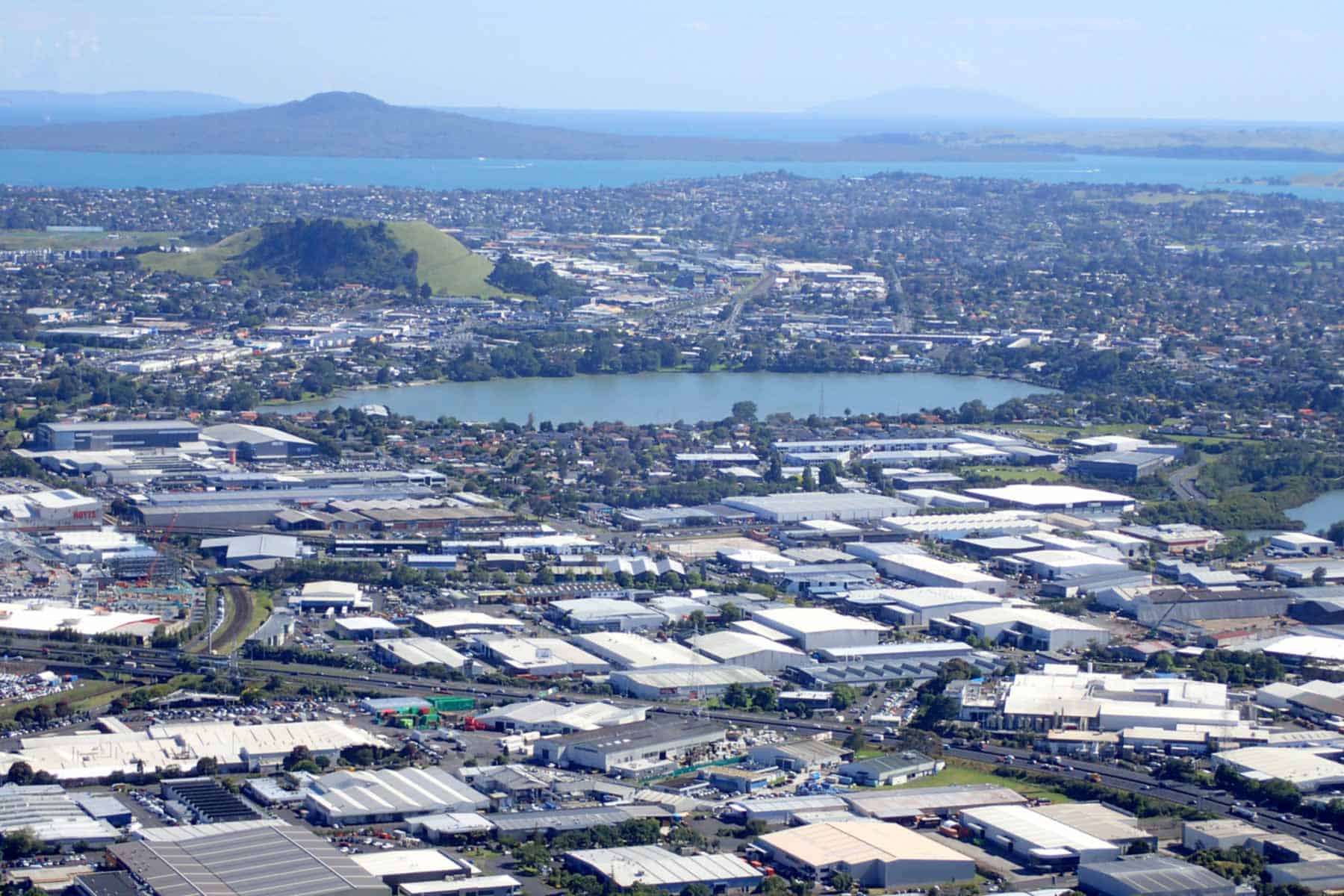
Te Kopua Kai-a-Hiku / Panmure Basin is a 1.5km diameter explosion crater formed by a series of wet eruptions 25,000 years ago. These threw out a large volume of volcanic ash and broken up Waitematā sandstone, building up a 25m high tuff ring that encircles the basin.
Recent drilling has shown that the wet explosive style of eruptions that formed the basin later switched to dry fire fountaining. This built a small scoria cone inside the explosion crater, the top of which is now buried beneath the mud-filled floor.
Layers of bedded ash can be seen around the basin shores and in the cliffs on either side of the channel at the entrance. These show that some of the tuff ring’s inner slopes slumped back into the crater during the eruptions and this chaotic pile was later buried by further ash layers.
Previous reports of a buried fossil forest beneath the tuff on the banks of the Tāmaki appear to relate to a much older fossil forest preserved within the underlying 1 million-year-old black peat.
Fine scoria can be seen in a small cutting on the side of the round the basin pathway at the end of Cleary Road. After volcanic activity ceased, the crater filled with fresh water creating a lake. The crater has been a tidal lagoon for the last 8,000 years.
Human history
The traditional name is Te Kopua Kai-a-Hiku, meaning ‘the eating place of the guardian taniwha Moko Ika Hiku Waru’, which is also the origin of the name Mokoia, the former Māori village located at the basin’s north-eastern entrance. On the west of Mokoia was the sacred spring Te Waipuna-a-Rangitātea, named by the Tainui crew after a spring in East Polynesia.
Mangroves that dot the shoreline of the basin are remnants of a once more extensive mangrove forest margin. Bird life is plentiful around the tidal flats with ducks, gulls, white-faced herons, kingfishers and little and black shags. A small colony of pied shags can be seen nesting in the trees beside the entrance channel.
The European name, Panmure Basin, was given by Governor Sir George Grey after the English Secretary of War at that time. From the 1960s to 1923, the Ireland Bros Tannery operated on the island. After the tannery closed, the lagoon area was owned by Theodore Van Damme, who set about beautifying it with numerous plantings and paths. It passed into public ownership in 1975. Today, the Auckland Society for Model Engineers has a clubhouse, miniature railway line and model boat pond and the Panmure Lagoon Sailing Club has its clubhouse and boat lockers.
Te Apunga-o-Tainui / McLennan Hills
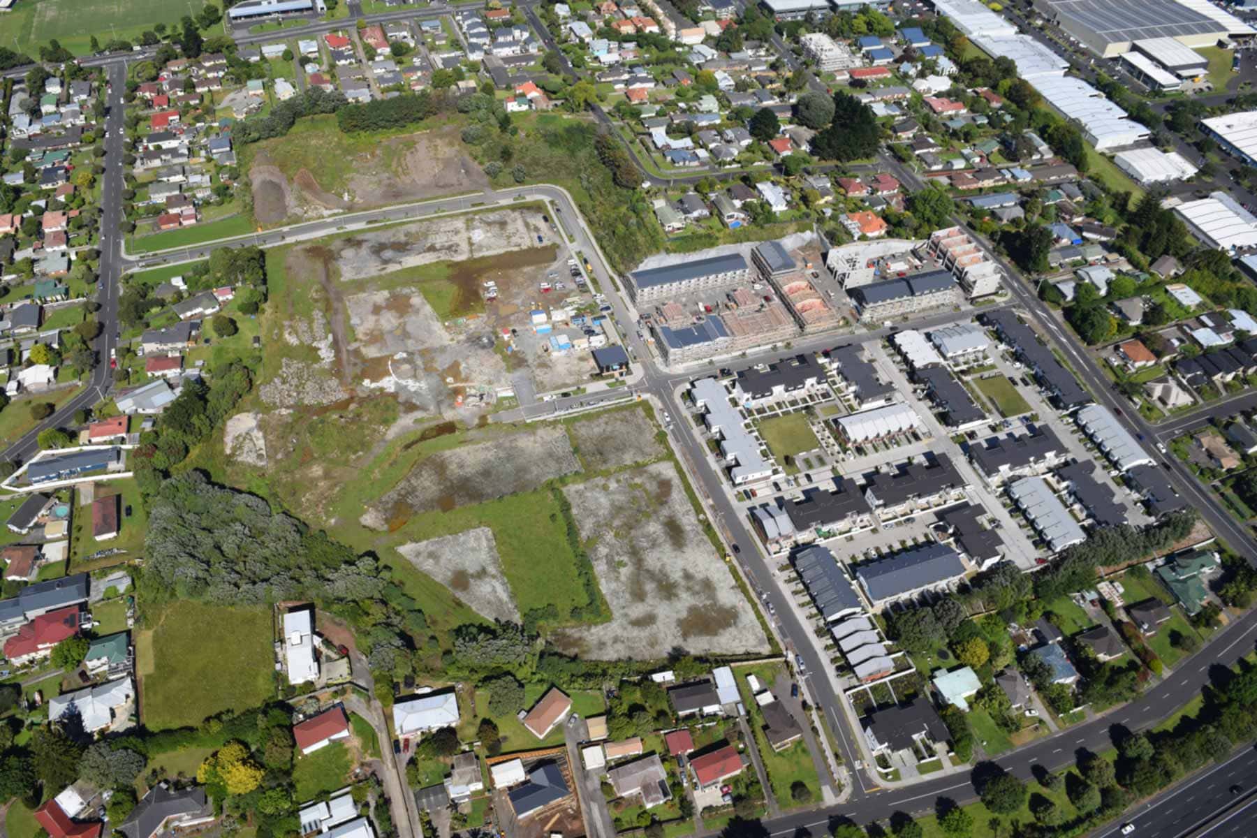
Te Apunga-o-Tainui / McLennan Hills Volcano consisted of four small scoria cones, each with a central crater that erupted in the middle of an explosion crater with surrounding tuff ring. Lava poured out from the base of the cones, filling the explosion crater and burying most of the tuff ring as it flowed out to the north, east and south, forming a small shield volcano. The flows spread all the way to the sea, forming the coast of the Tāmaki Estuary from Ōtāhuhu North to the Panmure Basin tuff ring near Waipuna Road Bridge.
Most of the northwestern lava flows and scoria cones of Te Apunga-o-Tainui / McLennan Hills are mantled by ash from neighbouring Ōtāhuhu / Mount Richmond, indicating that it erupted about 40,000 years ago, before Ōtāhuhu / Mount Richmond.
These two volcanoes and Mount Robertson blocked the Tāmaki River from flowing into the Māngere branch of the Manukau River system. The blocked Tāmaki River began flowing northwards in the opposite direction, eroding down its course.
Human history
The original te reo Māori name Te Apunga-o-Tainui marks the river that flows from the north to the south of the Manukau River system and may refer to the bow wave or prow of the Tainui Canoe, or the point where the canoe landed about 600 years ago.
Europeans named McLennan Hills after European landowner and Member of Parliament Ewan McLennan. Apart from a small quarry on the northeastern cone, the hills were untouched until 1952, but during the 1950s and 60s, the scoria cones were completely quarried away.
For several decades, the flat platform was used for greenhouses, however, in the late 2010s, a new subdivision of terrace houses and apartments were built.
Ōtāhuhu / Mt Richmond
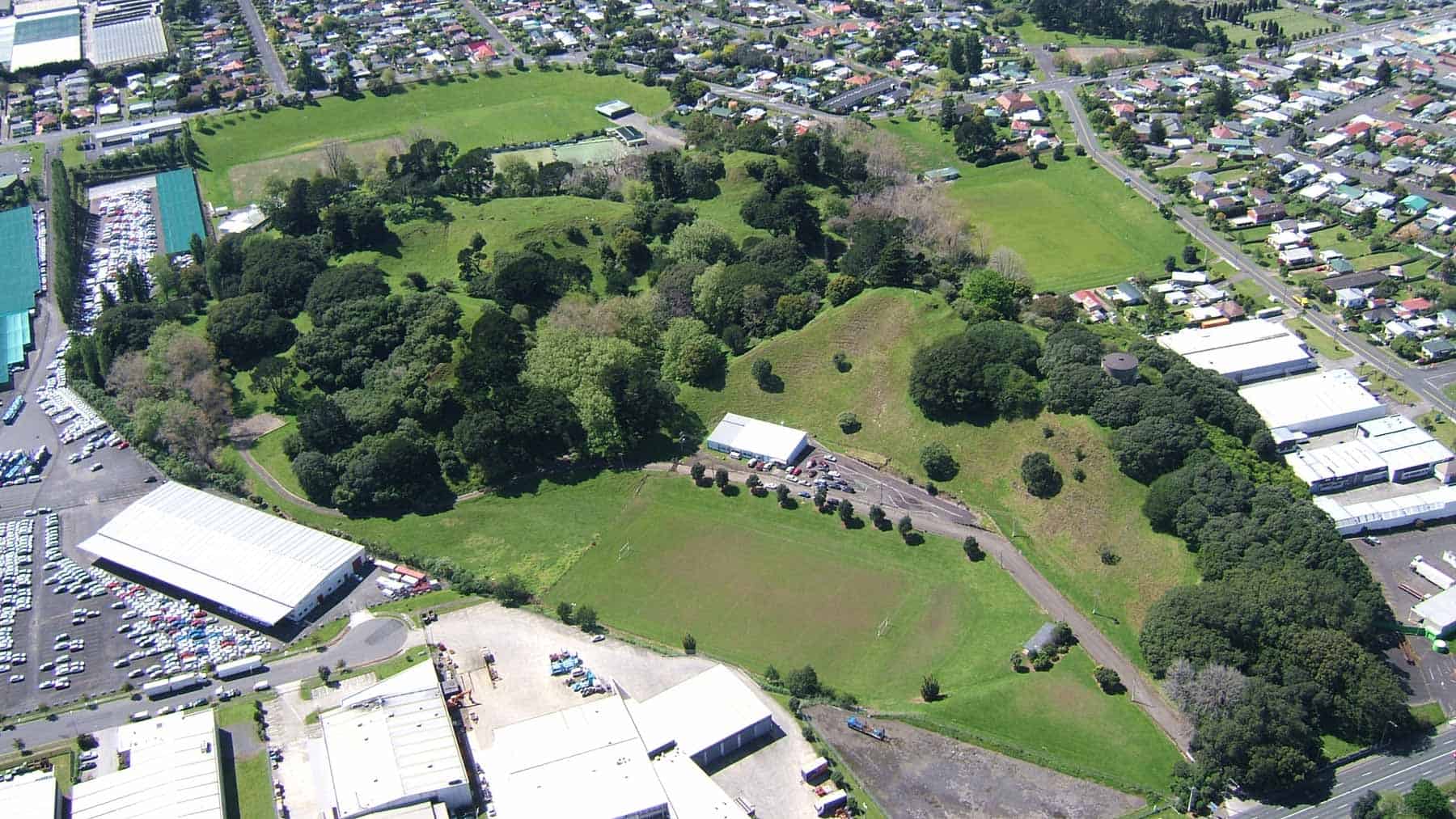
Ōtāhuhu / Mount Richmond erupted about 30,000 years ago, blasting its way through the south-western side of the tuff ring and lava flows of Te Apunga-o-Tainui / McLennan Hills. Currently, Ōtāhuhu / Mount Richmond consists of the partially quarried remains of several scoria cones formed by fountaining from a number of vents. The cones sit in the middle of an 800-metre diameter explosion crater and surrounding tuff ring with its lowest rim to the west.
The sites of four scoria quarries lie within Mount Richmond domain and can easily be confused with the two smaller circular craters in the middle of the complex. Following cessation of volcanic activity, the moat between Ōtāhuhu / Mount Richmond’s scoria cones and the tuff ring became a swamp.
Human history
The name Ōtāhuhu is a reference to Te Tahuhutanga o Te Waka Tainui, which translates as the ridgepole of the Tainui waka / canoe. The name recalls the portage of the Tainui waka from the Waitematā Harbour to the Manukau Harbour just to the south of the Maunga in the 14th century.
All of the volcano’s scoria cones were extensively modified with surface earthworks for occupation sites and defensive pā in prehistoric times. There are numerous large and small kūmara storage pits. Particularly impressive is the high, steep-sided defensive position at the eastern end of the complex. The mountain was of strategic importance as it commanded the main Waitematā-Manukau Canoe Portage. More information is available at the Tūpuna Maunga Authority website.
The European name comes from Major Richmond, a friend of Governor Sir George Gray’s in the 1850s.
Much of the northern part of the tuff ring was flattened during industrial subdivision. In places it is difficult to recognise the original shape of the scoria cones and tuff ring because substantial parts have been removed.