Overview
Rangitoto is a basaltic shield volcano that erupted after the arrival of Māori in the Auckland region (c. 1280 AD). It is the youngest and largest volcano in the Auckland Volcanic Field (AVF).
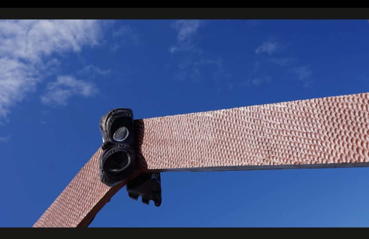
Rangitoto Island’s full name is Te Rangi-i-totongia-ai-te-ihu-o-Tamatekapua (the day that Tamatekapua had a bloody nose). It was named after a fight between Tamatekapua, captain of the Te Arawa voyaging canoe, and the Tainui canoe captain, Hoturoa. The name for the top peaks of the island is Ngā Pona e Toru o Peretū (the three knuckles/peaks of Peretū). Peretū is a celebrated Māori ancestor of Ngāi Tai ki Tāmaki, one of the iwi with Mana Whenua over Tāmaki Makaurau. The main carving on the waharoa (entrance way) set by Ngāi Tai ki Tāmaki is of Peretū.
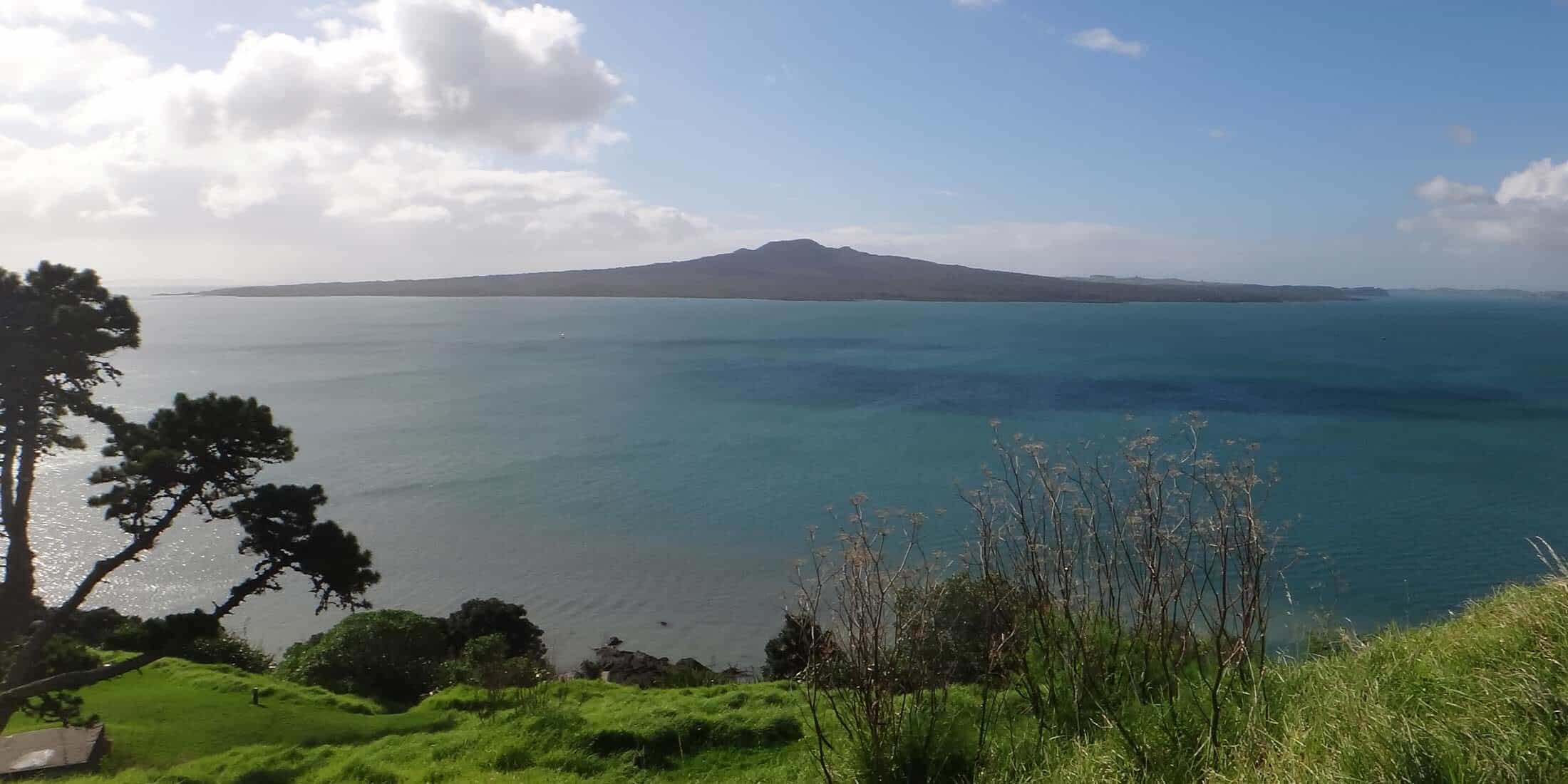
Located in the Waitematā Harbour, Rangitoto Island is an iconic part of Auckland’s landscape. Rangitoto is the only AVF volcano known to have erupted more than once and to have erupted two different types of lavas. Rangitoto’s lava makes up ~41% of the total volume of the entire AVF, which means it is almost as big as all the other volcanoes combined.
The way Rangitoto erupted in the past created a broad-based volcano with shallow slopes, creating a shape similar to a shield.
Among the island’s volcanic features are overlapping lava flows on the lower slopes and lava tunnels (“lava tubes”) linked by lava trenches on the south-eastern flanks. Lava tubes form when lava develops a crust while flowing, eventually draining and leaving a long, empty cave-like structure. Rangitoto has 3 lava tubes that visitors can enter.
The summit scoria cones are steeper and rise from a “moat” at the top of the lava slopes. Two outer cones flank the central cone and crater. The scoria at the summit was formed by fire fountaining.
We know there were people around during the last Rangitoto eruption because footprints of an adult, a child, and a dog were found in a layer of Rangitoto ash on Motutapu Island. These footprints are a tino taonga (immense treasure) of Ngāi Tai ki Tāmaki and currently reside in the Auckland Museum.
Facts and figures
Height of summit
260 m
above sea level
This is 40 m higher than the Sky Tower.
Lava volume
~0.7 cubic km
which would fill 280,000 Olympic swimming pools!
Width of the island
5.5 km
Crater depth
60 m
Crater diameter
200 m
Geological history
Scientists think Rangitoto erupted at least twice, once about 600 years ago and again about 550 years ago. In 2014, scientists drilled 150 m into Rangitoto’s upper flank. They drilled through layer after layer of lava until they hit the pre-eruption sediments.
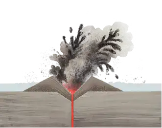
When it erupted ~600 years ago (1), molten rock called alkali basalt erupted into the Waitematā Harbour and hit cold water, causing an explosive eruption. Known as phreatomagmatic activity, this water-magma interaction created an explosion crater surrounded by ash deposits, which scientists call a tuff ring. The base surges from this eruption caused the ash deposits on Motutapu and immortalised the footprints of Tainui.
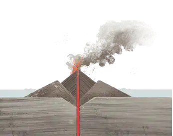
Over time, the tuff ring walls got so high that they blocked the water from reaching the vent (2). Lava then began to erupt and cool inside the tuff ring, eventually building up a pile of volcanic rock called a scoria cone.
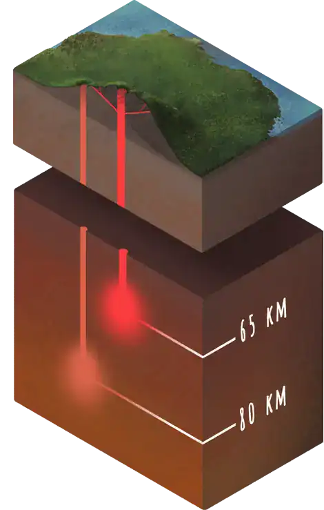
The magma erupted ~600 years ago is the same type of magma erupted from all of the other volcanoes in the AVF. Scientists think it formed by melting mantle rock around 80 kilometres deep in the Earth.
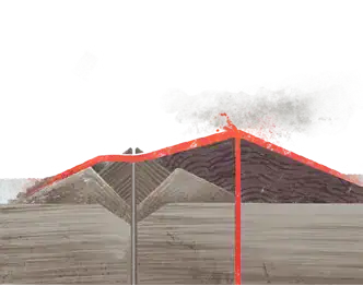
When Rangitoto last erupted, 550 years ago (3), a new batch of lava erupted through the old deposits, forming a new vent. As the volcano continued to erupt, lava flowed away from the vent and cooled. Eventually these flows built up, covering the old tuff ring and creating the current topography of the island, including the central summit cone and crater.
This eruption’s magma, however, was subalkaline basalt, which is a magma that contains less sodium and potassium and more silica than the other type of magma that had previously erupted in the Auckland Volcanic Field. Scientists think this magma formed shallower, just ~65 km beneath the surface. The rise of the earlier, deeper magma may have triggered the later, shallower melting.