
Te Tātua-a-Riukiuta / Three Kings
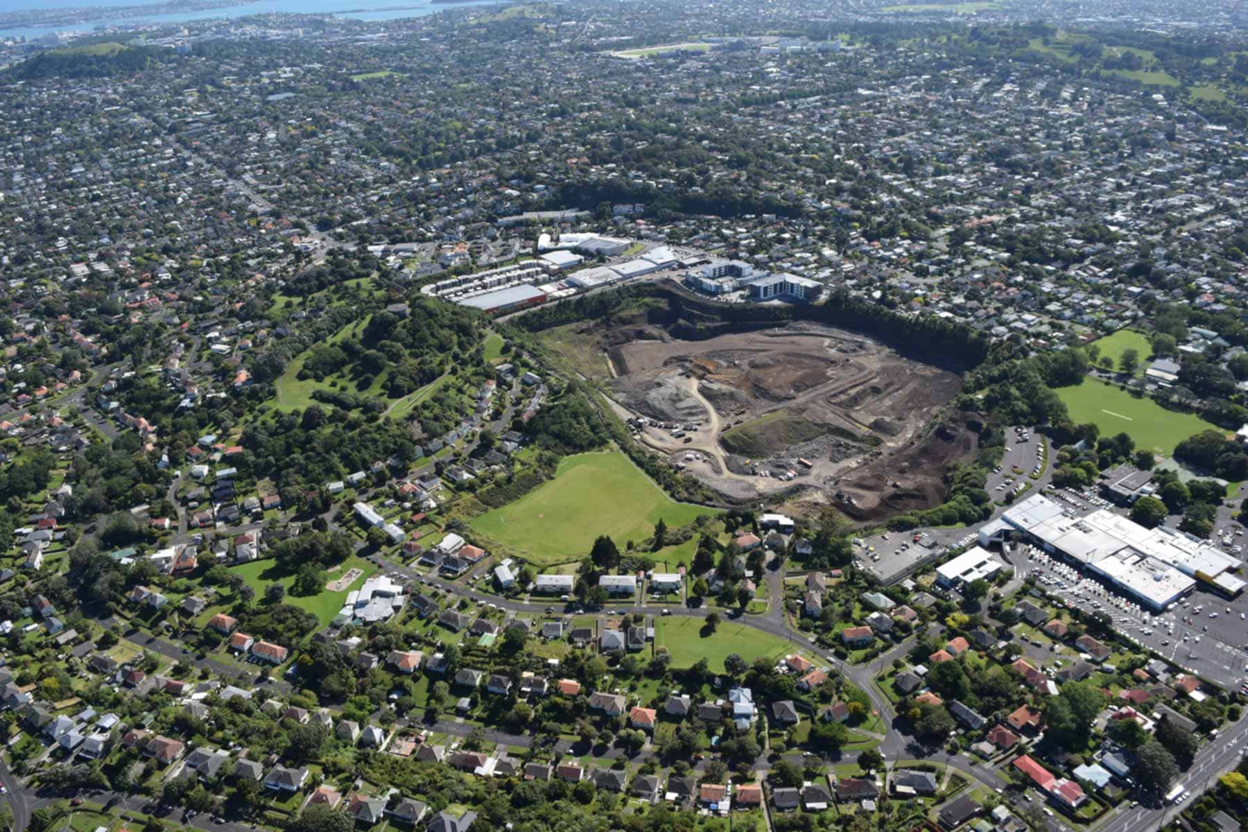
Te Tātua-a-Riukiuta / Three Kings erupted with massive wet explosive blasts 28,500 years ago. The result was the largest explosion crater in Auckland: 1km across and over 150m deep. Volcanic ash blew as far as Remuera and base surges of hot ash blasted out, building up a tuff ring that completely enclosed the volcanic vent. Following the wet explosive eruptions, dry fountaining began from a few different vents within the crater, partially filling it and creating three significant scoria cones and around a dozen smaller scoria mounds. At the same time, molten lava burst forth and filled much of the crater, breaching the tuff ring and flowing downstream 3km to Western Springs.
The lava lake in the crater crusted over with solid basalt as it cooled, but before the whole lake solidified, the underlying liquid lava drained out, creating some of Auckland’s most accessible lava caves. The openings to these caves are all on private property.
Human history
An early name for this Maunga is Te Tātua o Mataaho, translating as the belt of Mataaho, a Māori atua (deity) known as the guardian of secrets hidden in the earth. The name Te Tātua a Riukiuta refers to Riukiuta, a tohunga (priest) of the Tainui waka / canoe.
Te Tātua a Riukiuta was once the site of a pā, and the remaining Maunga has retained kūmara pits and terracing. More information is available at the Tūpuna Maunga Authority website.
The European name comes from the Three Wise Men of Christian tradition. Only one of the original three scoria cones is still standing after intensive quarrying. In 1927, the Wesleyan Native School donated this last cone (called Big King) and land to the government as a reserve, which saved it from the diggers.
You can follow the lava flow through back yards and streets in Mt Eden South, Balmoral, Sandringham, St Lukes, Morningside and Western Springs. Three Kings School’s stone walls were constructed from the rubbly surface of the old lava lake by unemployed workers during the Great Depression in the 1930s.
Puketāpapa / Pukewīwī / Mt Roskill
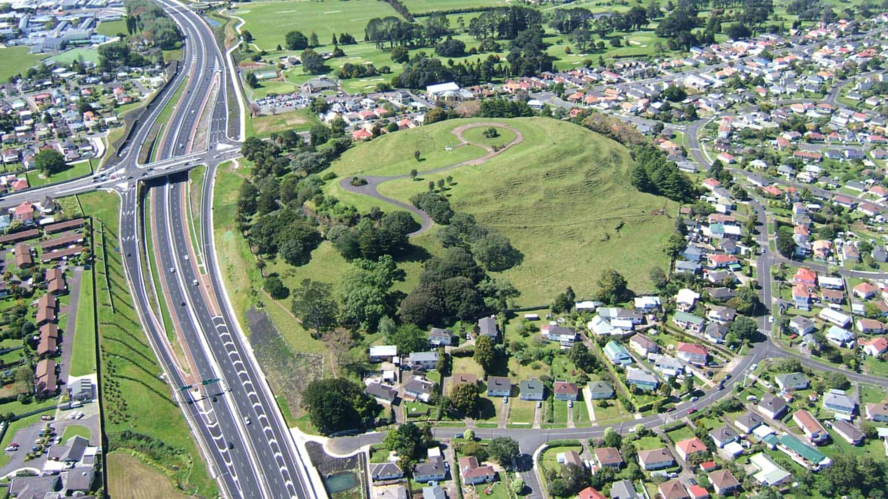
Puketāpapa / Pukewīwī / Mt Roskill started with initial wet eruptions about 105,000 years ago. These built a tuff ring, which can still be seen around the southwest side of the maunga. The rest of the tuff ring was buried by later dry fountaining eruptions from two vents, which built a scoria cone. The two original craters can’t be seen because the water reservoir and parking lot at the north end of the summit were built over them.
Lava flow flowed both north and west. This lava flow with the lava from Te Ahi-kā-a-Rakataura / Ōwairaka / Mt Albert partially dammed a local creek, creating the swampy areas that Ōwairaka (the water of Raka) was named after.
Human history
This maunga was a pa site prior to colonisation, with extensive terracing and storage pits. Pukewīwī means ‘hill covered in rushes’ and Puketāpapa means ‘flat-topped hill’. More information is available at the Tūpuna Maunga Authority website.
The English name was given by Alexander Kennedy and is a mis-spelling of Roskhill in Scotland; but it was also referred to as Mt Kennedy in the 19th Century. Tennis courts and a croquet lawn were bulldozed for the Southwestern Motorway.
In the 2000s, the Auckland Volcanic Cones Society successfully won an Environment Court Case to stop a substantial vertical cut through the cone as part of a motorway extension, instead accepting a cutting contoured to look like the slope of the cone.
Te Ahi-kā-a-Rakataura / Ōwairaka / Mt Albert
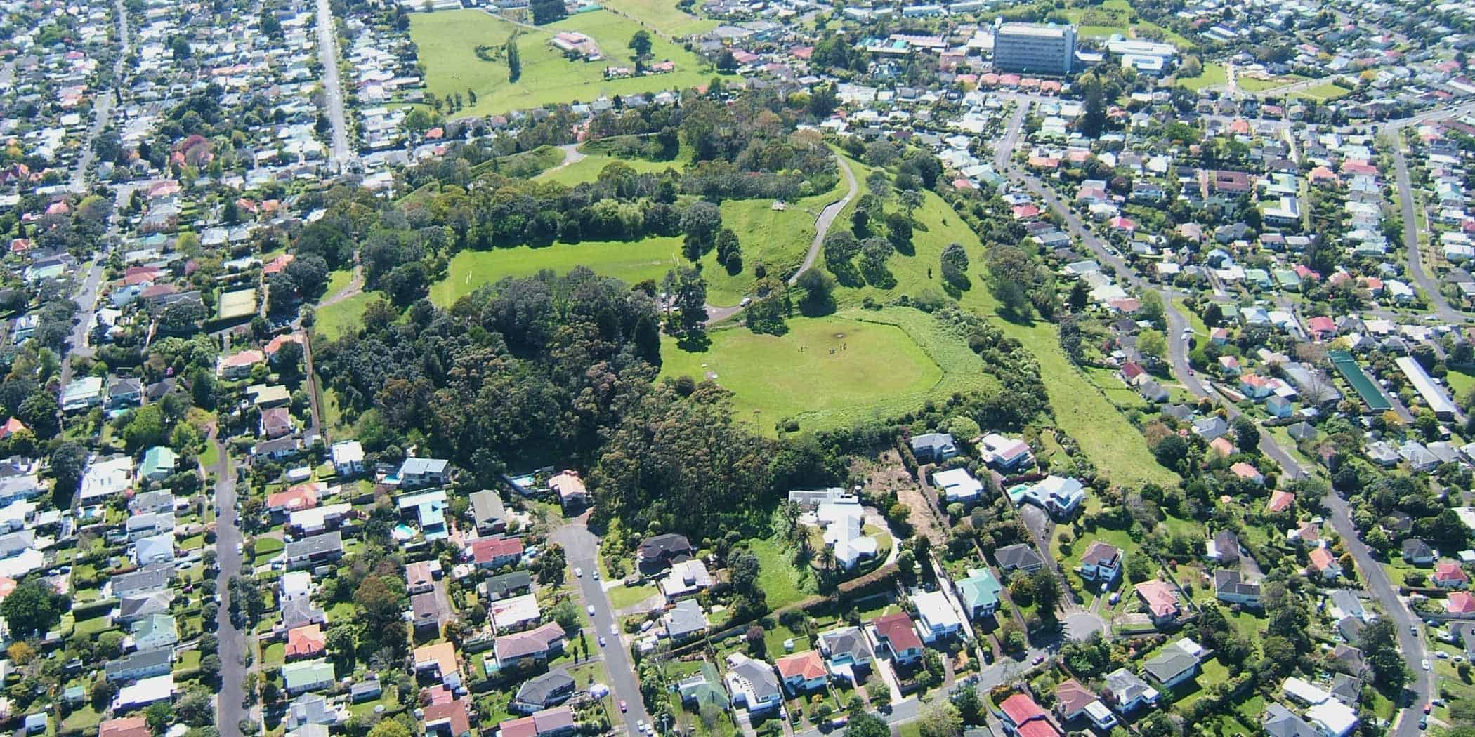
Te Ahi-kā-a-Rakataura / Ōwairaka / Mt Albert is the westernmost volcano in the Auckland Volcanic Field and erupted about 120,000 years ago. The earliest eruptions were wet and explosive and created a tuff ring, which was then buried by a large complex scoria cone thrown up during dry fountaining eruptions.
Lava extruded from lower flanks of the cone, flowing both south and north. The southerly lava blocked a local creek, forming the Ōwairaka swamp. The lava that flowed north reached the present-day shore of the Waitematā harbour and into the Meola valley. These lava flows created a number of lava caves.
Human history
Ōwairaka means ‘the dwelling place of Wairaka’. Another name is Te Ahi-kā-a-Rakataura, meaning ‘the long burning fires of Rakataura’. Rakataura was the leading tohunga on the Tainui waka (canoe).
This Maunga was extensively modified by Māori in pre-European times to form a defensive pā featuring terraces, pits, ditches and banks, but only small remnants remain. More information is available at the Tūpuna Maunga Authority website.
The colonisers named the maunga Mt Albert after Queen Victoria’s husband.
The top of the maunga has been lowered and extensively modified by quarrying and the installation of a flat-topped water reservoir in the 1940s. Decades of public protest finally halted the quarrying in the 1960s.
The top of the scoria cone is part of Mt Albert-Ōwairaka Domain administered by the Tūpuna Maunga Authority. The lower slopes and lava-flow fields are mostly covered in privately-owned houses.
Te Hopua-a-Rangi / Gloucester Park
One of the Auckland Volcanic Field’s smaller craters, Te Hopua-a-Rangi / Gloucester Park erupted more than 30,000 years ago, blasting its way through a cap of lava from Maungakiekie / One Tree Hill.
Following the eruptions, the crater became a freshwater lake, until around 8,000 years ago. At that point, sea level rise after the last Ice Age breached the low tuff ring, making it a tidal basin.
Human history
Te Hopua-a-Rangi means ‘the basin of Rangi’ and may refer to the Waiohua ancestor, Rangihuamoa.
Early European settlers called it Geddes Bain after Alexander Geddes. Onehunga’s first wharf was built off the western arm of the tuff ring in 1858; and the basin was used as a boat harbour with sheltered mooring. In 1878 a new wharf with rail links was opened at the end of the eastern arm of the tuff ring.
By the 1930s the basin had silted up, and it became the Onehunga Council tip, which was levelled, grassed and turned into sports fields. It was named Gloucester Park after an English Duke who visited in 1934. Some of the reclaimed land was then used for the Onehunga Speedway and during WWII, US Army barracks were constructed on the park.
The explosion crater is now bisected by the Southwestern Motorway, with sports fields on the northern part of the reclaimed crater floor.